Category Archives: Microadventure

Crossing Singapore by Human Power

Hello everyone!

It’s been awhile since I posted, but just to let you know the activity has not died down.  I am like a duck in a pond, where above the surface I seem placid and calm but underneath the water my legs are moving like crazy!

I am in the process of designing and ready to start building a brand-new, completely unique, human-powered boat. But more on that later.

August was National Day here in Singapore and as a family we have been planning for sometime our first multi-day, human-powered expedition.  And where better to attempt it than the second highest densely populated country on earth – Singapore!

You can see from the video,  even with so many people jammed into a small country like this – the thought and planning that has gone into this country still allows people like us to make wonderful human-powered journeys through the multitude of beautiful parks and cityscapes, using footpaths and park connector networks. Of the entire 88km journey, only 2km was actually on the road!

Happy Exploring!

Captain Axe

Sea, salt and sex pegs!!!

Happy Monday morning folks – here in Singapore we are looking forward to Chinese New Year and a shortened work week ahead.  I celebrated the upcoming year of the goat (click here to read more about Chinese Zodiac signs) with a beautiful 24km paddle around an Island at the weekend – along with a friendly Singapore chap and two barking mad Australians.  We were lucky enough to see some beautiful wildlife, which got the Aussy’s especially excited – squealing in delight at the ‘sex pegs’ they saw running down the beach. (Literal translation “six pigs”).  Enjoy the short video made with my brand new GOPRO.

Climbing the Chief’s Apron, Squamish

In 2014 I found myself with one day to spare in the outdoor adventurer’s paradise city of Vancouver.  After some short research on google for a possible microadventure, there I was in a rental car, driving on the wrong side of the road out of town – destination Squamish.  Squamish is a town around a 1 – 2 hour drive depending on traffic north of Vancouver on the way to the popular ski resort of Whistler.  Squamish is a world class rock climbing destination – mainly because of a 700m massive granite wall located a few hundred metres from the centre of the town, knows as ‘The Chief’.  The lower part of the wall is known as the ‘Chiefs Apron’ and consists of lower angled slabs which lead about halfway up the main wall.

I broke two of my normal rules for adventuring – I hired a guide and secondly coupled with the cost of the rental car,  spent much more money than I would have liked (I have Scottish ancestry).  However I was a long way from home and was not sure if I would ever have the opportunity again so I went for it.  Below are some photo’s of the climb but the main summary was:

–  Jason my guide was a friendly chap

–  It rained like hell a few hours before and hence the rock was very slippery – making a normally strait forward climb feel rather hairy

–  Afterwards I was very glad for the opportunity to climb here and that I made the effort and spent the money – when you have the opportunity to try something unique and special take it, even it means breaking a few of your own rules!


The world’s best tasting coffee found on the summit of Fantham’s Peak!

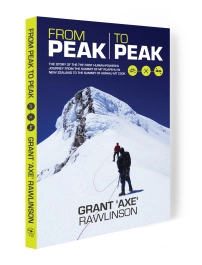
Once per year I return to my home province of  Taranaki in New Zealand.  Each visit is typically no longer than one week – but it can be a blur of meeting and catch up’s and whilst very nice to see familiar and friendly faces again after a long absence – I often wish the interactions can be more personal, and I had more one-on-one time with people.  In December 2014, Stephanie and I returned to Taranaki and noticed a beautiful day of gloriously settled weather just before Christmas.  We jumped at the opportunity to take a half day walk up Fantham’s Peak – the subsidiary summit of Mt Taranaki – our province’s highest mountain.  We were lucky enough to be joined by old mate Rob ‘the mountaineer’ Mills or more commonly known as ‘Millsy’.  Millsy recently shot to fame as one of the star characters in the book ‘From Peak to Peak’.  This is the inspiring true story of the first human-powered journey from the summit of Mt Ruapehu (2797m) in New Zealand to the summit of Aoraki/Mt Cook (3750m).  Millsy appears early on in the book for his bold ascent of the very icy and windy Mt Ruapehu – wearing crampons and an ice-axe for the very first time in his life.  A superb effort made even more amazing by the fact he still talks to me after I told him it would not be that difficult!

For the climb of Fantham’s Peak we met Millsy at 6AM in the small sleepy town of Stratford and 30 minutes later had driven to the road end and started our walk.  3.5 hours of sweat and toil later,  we were on top – enjoying some of Mum’s sandwiches and cup of coffee from the thermos.  I don’ t believe I have had a more delicious cup of coffee – EVER!  If you don’t believe me try it yourself – just remember its BYO.  I struggle to think of a better way to spend a good few hours  of quality time with dear people and create memories to last a lifetime.  I will let the pictures speak for themselves of our humble journey.  If you need more information on the route up Fantham’s Peak – check it out here.

From Wikipedia:

“Mount Taranaki, or Mount Egmont, is an active but quiescent stratovolcano in the Taranaki region on the west coast of New Zealand’s North Island. Although the mountain is more commonly referred to as Taranaki, it has two official names under the alternative names policy of the New Zealand Geographic Board. The 2518-metre-high mountain is one of the most symmetrical volcanic cones in the world. There is a secondary cone, Fanthams Peak (Māori: Panitahi), 1,966 metres (6,450 ft), on the south side.[7] Because of its resemblance to Mount Fuji, Taranaki provided the backdrop for the movie The Last Samurai

Inspiring People: Andrew Glass – human power from Singapore to Pulau Tengah

Adding to the ‘Inspiring People’ section of my website – today we catch up with an adventurous Australian, Andrew Glass – a.k.a ‘Glassy’.  Glassy recently had a family holiday and decided to spice it up by travelling to his Island destination completely by human power!  Read more about what he did, how he did it and what the biggest challenges were below:

[Axe]  Glassy thanks for taking time to catch up.  What was the nature of your adventure?

[Glassy] Hi Axe, Well we’d planned a holiday with 8 families to a resort in Malaysia, on an island 16km off the coast of Mersing, Pulau Tengah.  Inspired by your human powered achievements Axe, I thought I could attempt a human powered transit challenge myself by completing the journey under my own steam.  That meant cycling 154km from my home (Dempsey Hill, Singapore) to Mersing in Malaysia, then kayaking the 16km open water crossing to Pulau Tengah to have earnt the food, and comfort that comes with holidays!  When I initially proposed this idea to the other 8 dads (and any mums) who were coming on the trip, they all laughed and thought I was barking mad!

Map showing Glassy's route via bicycle and kayak

Map showing Glassy’s route via bicycle and kayak

[Axe] What gave you the idea to try something like this?

[Glassy] I was inspired by your blogs and the previous 28km open water kayaking trip you asked me to join to Pulau Pisang on West Coast Malaysia – which did scare me a bit while we were out there to be honest, but I really enjoyed the challenge and trip.

[Axe] How much pre-planning did you do?

[Glassy] This was the most important factor. I know how much you did for our Pisang trip and other adventures as an example.

While planning is important regardless, going alone made it even more important with no back up in case of a problem. I considered these issues in my pre-planning:

Cycle:  best time to make the ride? distance? estimated speed and arrival time? breaks? hydration? calories? safety lights, charged mobile, cards with emergency contacts and having people aware of what I was doing in case any problem en route.

Kayak: more daunting, requiring above but in addition, research into tides, currents, winds, expected weather, distance, speed and departure/anticipated arrival notification to police & the destination resort.

The SPOT Tracker satellite beeper that you lent me also gave me an added level of comfort/safety mate, thanks (You can see Glassy’s real-time GPS track at this link here).

 [Axe]  What was the biggest obstacles to PREPARING and planning for this trip?

[Glassy] Convincing my wife I would be OK and it was not as dangerous as EVERYONE was telling her (and me), particularly the cycle on Malaysian roads.

But there are no real physical obstacles for preparation, you just make lists and speak to people with experience to cover as many eventualities and prepare accordingly.

Glassy on the cycle ride meeting up with a friendly fellow road cyclist.

Glassy on the cycle ride meeting up with a friendly fellow road cyclist.

 [Axe]  Every REAL adventure has RISK.  How much RISK did your trip have, and how did you manage this to a level you and your wife were comfortable with?

 [Glassy]  The largest perceived risk was being run over on the cycle to Mersing. Axe, you were about the only one that did not try and convince me not to do it.

There is definitely risk, both in the cycle and the kayak. However, if you have made your mind up to deal with the risk, you just try and minimize it. E.g. plenty of lights on your bike, don’t ride with earphones and keep alert – not much more you can do. The kayaking risk was primarily nature. You do what you can to be aware of conditions and make the choice to proceed or not with logic, not testosterone. I had confidence from the Pisang trip that I could do it, knew I had done homework on conditions, had the safety gear with me and your tracking device. Risk evaluation and mitigation is the key.

Glassy set's out on the 16km paddle

Glassy set’s out on the 16km paddle

[Axe]   How much physical training was necessary for this trip?

[Glassy]  To be honest, not a lot. I am not in peak shape, but not untrained either. I cycle most days to/from work, occasional run and swim. I feel for something like this it is mostly mind over matter.

[Axe]   So you would say that mental strength is more important than physical strength for something like this? i.e. is it more importantly to be super fit and strong OR is was it more difficult to have the mental strength to commit yourself to the RISK and UNCERTAINTY?

[Glassy]  Mental strength and commitment without doubt.

[Axe]  What did your wife think about you attempting this?

[Glassy]  While not surprised, she was very concerned about the ride in particular and was till the morning still trying to talk me out of it – till I reminded her how much I am insured for,… joking (I hope!).

[Axe]  What was the success rate your gave yourself when starting this out of successfully finishing it?

[Glassy]  95%

 [Axe]  Did you ever feel like backing out?

 [Glassy]  It did cross my mind before departing as the weight of concern for the ride was large. However, once I left the house, It did not cross my mind again, I was 100% committed – if for nothing else, to prove all the naysayers wrong after I had shot my mouth off too much calling them all soft.

 [Axe]  Did you want to do this yourself or would you have liked a partner?

 [Glassy]  Honestly, I would have much preferred a partner for both comradeship, and even more so for safety.

 [Axe]  What was the best experiences/positives your gained from your trip?

 [Glassy]  Proving to myself I could do it at 41. Showing an example to my kids.

Actually just having the time to myself with no phones or anything while pursuing a goal is also quite refreshing.

And seeing/hearing the flicker of envy that the other dad’s on the island showed when I had arrived!

 [Axe]  What was the worst part about your trip?

[Glassy]  10km after stopping for my last break with 35km to go the rolling hills just got to me and the speed really slowed. The heat had risen and then I cramped up. Had to stop and walk 50m before remounting. Found my mojo again and sped up, but then 10km from Mersing was smashed by a rainstorm for the rest of the cycle, but just ploughed through it.

[Axe]  Would you do this again? If yes/no why? and what would you change?

[Glassy]  Yes, would do it again, but probably not exactly the same. I enjoyed it all, but there are infinite variants to that trip and others to do. I would like to do a different, larger challenge and with at least one other or a small crew next time.

[Axe]  Any advice for anyone else who is planning a similar trip?

[Glassy]  DO IT.   But, just do it smart. Plan well and do not be driven by ego etc. to continue if the risk level exceeds the tipping point of reasonable safety.

Glassy's car complete with kayak and bicycle on the way home from a family holiday he won't forget for some time.

Glassy’s car complete with kayak and bicycle on the way home from a family holiday he won’t forget for some time.

[Axe]  Glassy – thanks for your time – I personally found it inspiring to see what you managed to fit in to your family vacation. All the best for your future adventures!

An open water sea kayaking expedition to Pulau Pisang

To celebrate Chinese New Year (year of the horse), we saddled up our sea kayaks and took to the sea for an exploratory mission to Pulau Pisang Island (literally translating to ‘Banana Island’ in Malay). Pulau Pisang is located 14km off the coast of Malaysia in the Malacca Straits. The island officially belongs to Malaysia. However in 1900, Singapore signed an agreement with the Sultan of Johor which allowed them to operate a lighthouse from the Island in perpetuity. This has recently caused some political tensions between the two countries, mainly over sovereignty issues. We did not care too much about international politics as I believe the Island was there long before men were running around laying claim to certain pieces of the earth.

I had managed to convince Stephanie my wife and long-time rugby mate Andrew Glass (a.k.a ‘Glassy’) to join me. We set-off at 5:15AM from Singapore with two kayaks loaded up ( a double for Stephanie and myself and a single for Glassy). After an obligatory ‘athletes breakfast’ of roti prata (aka rote canai) in Gelang Patah in Malayia, we were in the water by just before 8am at the small town of Pontian and paddling.

It is a 14km open water paddle to reach the island. At this time of the year the prevailing winds are north-easterly due to the monsoon. Our paddle out to the Island took 2 hours and 30 minutes. Wind induced short period choppy swells sweeping in from behind made an uncomfortable journey as we were pushed and rolled around without warning. Stephanie and Glassy were amazed when I told them after 1.5 hours of paddling that the Island was still 7km away as it looked deceptively close.

We landed on the Island and had the company of some friendly Malay families who had come over in a boat and were swimming and enjoying themselves. We took a short walk to the lighthouse at the top of the Island which is permanently staffed and operated by Singaporean’s. They were very friendly to talk to and told us they work on a ten day on/ten day off shift.  It would be a beautiful part of the world to have your office.

We  enjoyed a tranquil lunch sitting on the small jetty on the Island before gearing up for the paddle back to the mainland. My water proof camera and waterproof GPS both gave up life on the journey meaning we steered mainly on a compass heading back the first half of the journey. The mainland looks so featureless from 14km away that it is hard to recognise features for navigation purposes. As we got closer Glassy recognised one of the landmarks to head for onshore. It was a good lesson not to completely rely on GPS or electronic navigation devices.

We arrived back after 2 hours and 15 minutes of paddling. Paddling across open water is a very different experience to coastal paddling (paddling alongside and parallel to the coastline). The scenery changes much slower in open water paddling. The conditions can get much worse and the commitment level is higher due to the fact if something goes wrong offshore then you can’t easily get into the safety of dry land. It can be an intimidating yet exhilarating feeling when you are so far from land with the weather conditions worsening. Stephanie’s arms were very tired and I was exceptionally proud of her for having the physical and mental strength to paddle for 5 hours, on her first open water crossing.

For anyone contemplating this paddle in the future, my advice to be wary that is longer than it looks to the Island!  If anything goes wrong out there you are pretty much on your own.  Cellphones do work from Pula Pisang so if you had a phone in a waterproof bag this would be a good back-up (and of course you must know who to call!). Navigation is also a challenge, especially if the visibility is poor. So prepare and train properly so that you have enough strength to paddle in choppy/windy condition’s for at least 5 – 6 hours, and enough experience to know what to do in the event that conditions change or something went wrong.

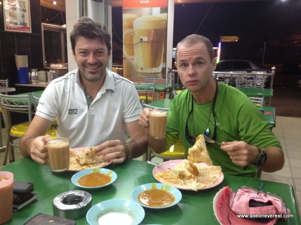
Could there be any better breakfast than this? Breakfast of champions - Roti Prata, fish curry and Teh Tarik!

Could there be any better breakfast than this? Breakfast of champions – Roti Prata, fish curry and Teh Tarik!

Sunrise from Pontian town on the west coast of Malaysia, our launching point.

Sunrise from Pontian town on the west coast of Malaysia, our launching point. (Photo” Andrew Glass)

Map of our route to Pulau Pisang in relation to Singapore.

Our GPS track of our route to Pulau Pisang in relation to Singapore.

A close up of our GPS track to Pulau Pisang starting from the small town of Pontian.

A close up of our GPS track to Pulau Pisang starting from the small town of Pontian. CLICK THE IMAGE TO SEE AN INTERACTIVE MAP DISPLAY OF OUR ROUTE!

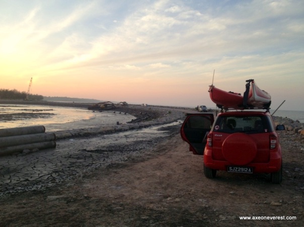
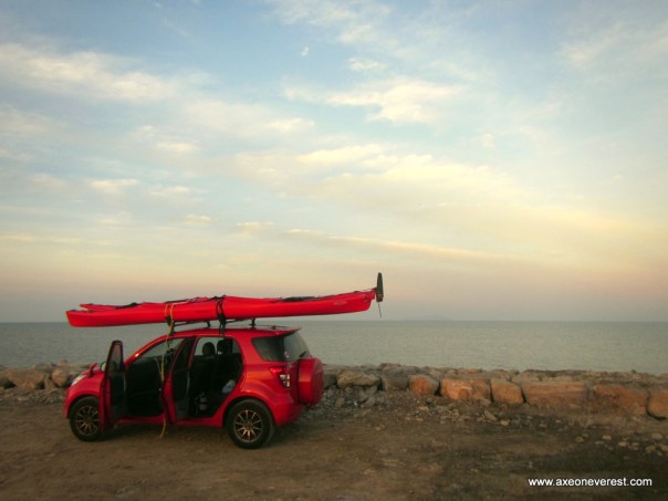
7AM arrival at Pontian, we found a new breakwater under construction which we managed to drive out and launch off.  From here Pulau Pisang is just visible 14km in the distance to the right of the vehicle.

7AM arrival at Pontian, we found a new breakwater under construction which we managed to drive out and launch off. From here Pulau Pisang is just visible 14km in the distance to the right of the vehicle.

Stephanie gets her feet wet at the bottom of the breakwater as we prepare to depart Pontian.

Stephanie gets her feet wet at the bottom of the breakwater as we prepare to depart Pontian.

Under way. Pulau Pisang still looks a long long way away. Stephanie's first open water kayaking trip and she was amazed how long it took to get to the Island.

Under way. Pulau Pisang still looks a long long way away. Stephanie’s first open water kayaking trip and she was amazed how long it took to get to the Island.

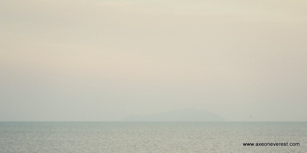
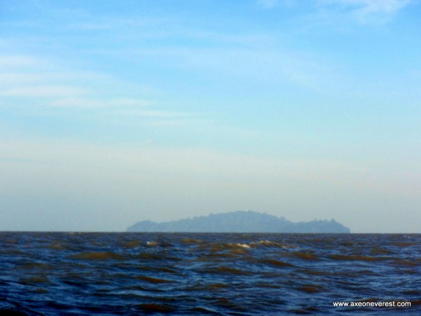
Pulau Pisang on a zoomed up shot from Pontian. Appearing as a ghostly haze on the horizon - about 13.5km as the crow flies.

Pulau Pisang on a zoomed up shot from Pontian. Appearing as a ghostly haze on the horizon – about 13.5km as the crow flies.

Halfway through the paddle - about 7km from Pulau Pisang.

Halfway through the paddle – about 7km from Pulau Pisang, the lighthouse starts to become evident as a white spec on top of the island.

After 2.5 hours we had almost reached the island and could see a small bay with a jetty which we headed for.

After 2.5 hours we had almost reached the island and could see a small bay with a jetty which we headed for in centre right of photo. This view is the east side of the Island. I had originally planned to kayak around the island however the wind and thought of the long slog to get back to the mainland meant I scrapped this idea. Maybe another time.

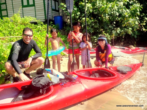
Stephanie and Glassy make friends with the local kampong kids on the island.

Stephanie and Glassy make friends with the local kampong kids on the island.

The jetty on the Pulau Pisang.  There is one Malay family which lives here.

The jetty on the Pulau Pisang. There is one Malay family which lives here.

The island is full of lovely little lizards such as this green one here.

The island is full of lovely little lizards such as this green one here.

We wandered up the hill to the lighthouse.  Access is denied so we took a photo from outside.

We wandered up the hill to the lighthouse. Access is denied so we took a photo from outside.

Stephanie having lunch on the jetty on Pulau Pisang.

Stephanie having lunch on the jetty on Pulau Pisang.

Glassy tucking into his delicious pasta lunch which he shared with us.

Glassy tucking into his delicious pasta lunch which he shared with us.

On the way home. The mainland looks a long way away and we were concerned about the wind picking up.  We made it back in 2h15mins.

On the way home. The mainland looks a long way away and we were concerned about the wind picking up. We made it back in 2h15mins.

V for Victory! I was very proud of Stephanie for paddling 28km in an open sea crossing like this.  She was pretty tired but never missed a stroke for 5 hours paddling.

V for Victory! I was very proud of Stephanie for paddling 28km in an open sea crossing like this. She was pretty tired but never missed a stroke for 5 hours paddling.

House hunting in Iskander: A seakayaking microadventure in search of a home

A journey to the end of Asia – Kayaking Tanjung Piai

In 2005 I attempted to walk to the very end of the mainland South American continent.  The most Southern Point of mainland South America is known as ‘Cabo Froward‘ and access involves a challenging 5 – 6 day walk along an unmarked trail following the rugged Patagonian coastline.  The trek must be carried out completely independently (no hostels or stores along the way!) so we carried everything we needed.   With numerous river crossings, horrific weather, no communications with the outside world, a walk to Cabo Froward is an enticing challenge.  Things did go wrong for us.  It rained so hard the rivers which were normally knee high, came up to my neck.  We aborted our mission on day two and only just managed to get back out again to the road head.  It was the scariest river crossings I have ever done, the final river we crossed on the way out was high in flood, the waters ran swift and we were forced to cross close to the river mouth which was flowing directly into the sea.  We had to dodge huge trees and logs which were being swept down the river by the flood waters and I was sure we were going to get swept out to sea.
While reflecting on this trip recently, I become curious as to where the Southern most tip of the mainland Asian continent happened to be.  It turns out it is only about 50km from my apartment!   It is known as Tanjung Piai,  and is located at the very southwest tip of Peninsula Malaysia in the state of Johor.  (Sentosa Island in Singapore also claims to be the Southern most tip of continental asia.  However Singapore is an island and their interpretation of this is due to the fact that Singapore is connected to Malaysia by man-made bridges, which do not count when we are looking at the actual natural continental land mass) Together with my wife Stephanie, we set-off on the 12 – 13 October 2013 to make our way to the tip of the Asian continent.  Our mode of travel was the ‘Divorce Machine’ (Our inflatable sea eagle fast track kayak).
We started at Puteri Harbour in the state of Johor.  On the 1st day we paddled for 6 hours, 25km in total, down the south-west coast of Malaysia to the small resort of Tanjung Piai.  We spent the night here in a basic but comfortable resort accommodation.  The next day we rounded the very tip of Tanjung Piai, then headed north up the coast to the small fishing village of Kukup.  A shorter day of 12.5km.   Here we deflated the ‘divorce machine’ at the Kukup ferry terminal in front of a very curious crowd of onlookers, packed her into a taxi and headed back to Puteri harbour to collect our car.   It was a fantastic journey, we paddled through intense sunshine, tropical downpours and choppy waves. We saw families of sea-otters, flying fish and forests of mangroves lining the seashores. We got sun burnt, ate the best roti prata and enjoyed two days of adventure in each others company in a beautiful part of the world.   All for the total cost of S$60 each, some physical effort and some imaginative planning.  That’s what microadventure is all about! Enjoy the photo’s below.
Map of our route on day one with km markings.

Map of our route on day one with km markings.

Map of our route on day two with km markings.

Map of our route on day two with km markings.

Stephanie fueling up on Roti Canai in Gelang Patah before we start.  This stuff is heavy and no need to eat for a few hours afterwards, perfect for kayaking!

Stephanie fueling up on Roti Canai in Gelang Patah before we start. This stuff is heavy and no need to eat for a few hours afterwards, perfect for kayaking!

We started the journey from Puteri Harbour. This friendly security guard allowed us to use the private jetty.

We started the journey from Puteri Harbour. This friendly security guard allowed us to use the jetty.

The Divorce Machine felt right at home as we paddled her our past some other very expensive pleasure craft.

The Divorce Machine felt right at home as we paddled her out past some other very expensive pleasure craft.  Stephanie asked why all the other boats had motors except ours.

The entrance to Puteri Harbour

The entrance to Puteri Harbour

Heading south west - the second link bridge linking Singapore to Malaysia in the distance.

Heading south west – the second link bridge linking Singapore to Malaysia in the distance.

Underneath the second link bridge.

Underneath the second link bridge.

Stephanie celebrating the 1st 8km of the trip after crossing under the 2nd link.

Stephanie celebrating the 1st 8km of the trip after crossing under the 2nd link.

Having a wee swig of 100-plus after we finish the first 8km leg to the 2nd link causeway.

Having a wee swig of 100-plus after we finish the first 8km leg to the 2nd link causeway.

It rained really hard for a short time which was beautiful as it cooled us down. Kayaking in the rain is actually a very pleasant experience in the tropics.

It rained really hard for a short time which was beautiful as it cooled us down. Kayaking in the rain is actually a very pleasant experience in the tropics.

Passing a platform as we get closer to Tanjung Pelepas port

Passing a platform as we get closer to Tanjung Pelepas port

Tanjung Pelepas port in the distance - the wind picked up and the sea go choppy as we crossed here.

Tanjung Pelepas port in the distance – the wind picked up and the sea got choppy as we crossed here.

Stephanie relaxing at a small beach we found on Tanjun Pelepas port.

Stephanie relaxing at a small beach we found on Tanjung Pelepas port.

Heading the last leg of the day, across to the lighthouse at Tanjung Piai, it seemed to take forever.

The last leg of the day, across to the lighthouse at Tanjung Piai, it seemed to take forever.

Finally arriving at the jetty at Tanjung Piai.

Finally arriving at the jetty at Tanjung Piai.

Tanjung Piai resort is situated 2km from the actual tip of the continent.

Tanjung Piai resort is situated 2km from the actual tip of the continent.

Stephanie outside the front entrance - 'Selamat Datang' means 'Welcome' in Malay.

Stephanie outside the front entrance – ‘Selamat Datang’ means ‘Welcome’ in Malay.

The jetty we landed on from Tanjung Piai.  This is the view from our room.

The jetty we landed on at Tanjung Piai. This is the view from our room.

A view of our room on the top right in the building in this photo.  Taken from the jetty.

A view of our room on the top right in the building in this photo. Taken from the jetty.

All I need to keep me happy at the end of a hard day, TV, a good book and a bag of chips.

All I need to keep me happy at the end of a hard day, a nice bed, a good book and a bag of chips.

I went for a walk in the morning around Tanjung Piai and found this small river.

I went for a walk in the morning around Tanjung Piai and found this small river.

The view as the sun rises from Tanjung Piai resort down towards the very tip of the Asian continent - still 2km away.

The view as the sun rises from Tanjung Piai resort down towards the very tip of the Asian continent – still 2km away.

Sun rise from our room.

Beautiful sunrise from our room.

Launching the Divorce Machine from the jetty was a small challenge as the tide was so low. Lucky she is lightweight.

Launching the Divorce Machine from the jetty was a small challenge as the tide was so low. Luckily, she is lightweight.

Setting up the SPOT GPS tracker on the front of the Divorce Machine at the start of Day 2.

Setting up the SPOT GPS tracker on the front of the Divorce Machine at the start of Day 2.

Passing the very tip of mainland Asia. The cape of Tanjung Piai.

Passing the very tip of mainland Asia. The cape of Tanjung Piai.

A close-up of the sign marking this point.

A close-up of the sign marking this point.

Paddling up the west coast of Malaysia towards Kukup fishing village.  The water was so shallow even though we 200m offshore.  I decided to jump out and sunk up to my knee's in very soft mud.

Paddling up the west coast of Malaysia towards Kukup fishing village. The water was so shallow even though we  were 200m offshore. I decided to jump out and sunk up to my knee’s in very soft mud.

Paddling towards Kukup village.

Paddling towards Kukup village we passed many fisherman.

Coming into the ferry terminal at Kukup village.

Coming into the ferry terminal at Kukup village.

Coming into Kukup ferry terminal we had a crowd of curious onlookers.

Coming into Kukup ferry terminal we had a crowd of curious onlookers.

The end! Getting ready to disembark at Kukup ferry terminal.

The end! Getting ready to disembark at Kukup ferry terminal.

I love this sign as we drove back into Singapore!  'Welcome to Singapore' on one side. 'Death to Drug Traffickers' on the other!

I love this sign as we drove back into Singapore! ‘Welcome to Singapore’ on one side. ‘Death to Drug Traffickers’ on the other!

This blog is listed under a section on my website called ‘Microadventure’.  Microadventures are cheap simple adventures close to home. A chap named Alistair Humphreys coined the phrase ‘microadventure’, you can read about him here.  I will continue to add more microadventures to my website to give people idea’s and inspiration to go on your own adventures.  If you do go on your own, I would love to hear about them and do drop me a line!

A Changi Airport transit stop microadventure – beach, beer and boats!

“What can we do with a 5 hour stop-over in Changi airport?” This was the question my friend Bevan asked me last week on while in transit through Singapore’s ultra-efficient Changi airport.

Bevan is a kiwi mate of mine whom I know from University days.  He is currently based in Sydney but had previously spent three years working in Hanoi.  I had visited him a number of times in Hanoi.  My visits typically involved him picking me up on his 100cc plastic motorcycle then cruising off for 20 sphincter clinching minutes through the madness of Hanoi traffic until I could not take it anymore.   Whereupon we would pull pull into the closest ‘beer hoi’ bar and I would begin to re-build my courage through downing 5 or 6 glasses of delicious, freshly brewed Vietnamese ‘beer hoi’.  All the total price of about $1.50.   Onwards we would then continue.  I had such fond memories of these trips and always liked re-telling the stores to others about this crazy kiwi who would double me around the streets of Hanoi.  This definitely classified as microadventure in my book.

I thought about the excitement that Bevan had introduced me to during our catch-ups in Hanoi.  Then I thought about what I could do with him in Singapore?  Meet on Boat quay or Clarke Quay?  Have a beer and some over-priced chilli crab?  Meet at Raffles Hotel for a $26 Singapore Sling?  Take him up Marina Bay Sands for a look at the view and some more horrendously priced drinks?  There is nothing wrong with doing any of these things.  I have done most of them many times.  But there is not a great deal of excitement or a sense of accomplishment in completing them.  I also have found when I show visitors these sites they often get an impression that Singapore is a concrete jungle and full of high-rise buildings! Well it isn’t. I wanted to show him a different side of Singapore.   A side very few people would ever get to see. I also wanted him to have an adventure.

So I decided to take Bevan on a microadventure.  A microadventure is a simple adventure, close to home, that does not break the bank account and fits into your time-frame.  We had 5 hours – that was plenty of time.  The hard part was to convince Bevan to join me.  I dropped him a message:

Me:  “How about I meet you at Changi Airport at 5:30PM, and I take you for a sea kayaking micro adventure?”

This apparently did not sound to appealing to Bevan and his answer was:

“Umm, paddling might be pushing it a bit for me mate! If it’s easiest I can just meet you in town – shall I take the airport train in and meet you somewhere, I would like to eat some local food?”

I tried again:  “This isn’t hard out at all, cruisy as…. we will paddle over to Pulau Ubin Island, just bring some shorts and a teeshirt – I will provide all the other gear – its where all the nice local food is (a slight lie) but if you prefer town that’s cool also”

This seemed to work I was rather happy to hear his reply: ” ok then,  bear in mind I may have a slight hangover and don’t make me miss my flight!”

Superb – we were all set!  I left work and raced out to Changi airport to pick up Bevan.  20  minutes later we were at Changi beach, unpacking and inflating the ‘Divorce Machine’ (my trusty Sea Eagle Fast Track inflatable kayak).  At 6pm we were in the water and paddling across the Johor Strait to Pulau Ubin Island.  We were headed for the small village on Pulau Ubin Island.  Pulau Ubin Island is the last place in Singapore that still has traditional village (Malays call it ‘kampung’) life.  It is only accessible by boat or kayak.  It is a beautiful island where you can mountain bike, swim or enjoy some beautiful seafood in the small restaurants that line the shoreline in the tiny village.

All set-up on Changi Beach ready to go.

All set-up on Changi Beach ready to go.

We paddled slowly across the Johor Strait, talking and laughing as we dodged ferry boats and larger vessels.  After 30 minutes we pulled into Pulau Ubin village just as the sun was beginning to set.  The evening was beautiful, the water was mirror smooth and the village was almost empty of people.   We wandered down the villages one small lane.  A couple of island dogs lay sleeping in the last rays of the sun.  They looked up at us disinterestedly as we wandered by.  We found a small store which was open and bought a beer each.  Bevan soon made friends with the lady who ran the store and quietly chatted away as we sat and enjoyed the peace and quiet of this tranquil location.

Paddling across the Johor Strait.

Paddling across the Johor Strait.

Bevan arrives at Pulau Ubin as the sunsets.

Bevan arrives at Pulau Ubin as the sunsets.

All too soon it was time to leave.  The view out over the water as we began the paddle back was stunning. Bevan told me about his life in Sydney, the activities he gets up to with his children and how he enjoys living in Australia.  The planes looked majestic and beautiful with their landing lights  lighting up the sky as they glided in on their descent paths to Changi airport.  Too far away for their engine noise to destroy the peace and quiet but close enough to enjoy their view.

Bevan enjoying a beer on Pulau Ubin with the friendly store owner

Bevan enjoying a beer on Pulau Ubin with the friendly store owner

We pulled back into Changi beach just as darkness fell at 7:20PM.  15 minutes later we had the Divorce machine packed up in the boot of the car and were sitting in the Changi Village Hawker centre eating plates of steaming noodles and rice.  With an appetite that only physical exercise can bring on, the food always tastes so much better.

I dropped Bevan back at the airport at 9PM, with plenty of time to catch his onward flight home to Sydney.  The total cost of the evening was $25 including the food and the beer. The only other thing it took was a little bit of time and effort.   Bevan’s parting comment to me as I dropped him at Changi terminal 3 was “That was the highlight of my whole week”.

It made me grin all the way home.

Bevan back at Changi Terninal 3 after a successful microadventure

Bevan back at Changi Terninal 3 after a successful transit-stop microadventure

The next time you have some guests in town, maybe you can consider taking them on microadventure?  There is so many amazing things to see and do in Singapore that do not break your bank account and burn up all your time.   At the very least they will show you a different side of this country that very few people ever get to see or enjoy, give you some exercise and you may even get a beer out of it! (If you want).

This blog is listed under a section on my website called ‘Microadventure’.  Microadventures are cheap simple adventures close to home. A chap named Alistair Humphreys coined the phrase ‘microadventure’, you can read about him here.  I will continue to add more microadventures to my website to give people idea’s and inspiration to go on your own adventures.  If you do go on your own, I would love to hear about them and do drop me a line!

Dodging Giants: A sea kayaking microadventure to Pulau Jong

Singapore has around 60 Islands, most are natural, some are man-made  and some no longer exist.  (See the complete list here).

Today with my wife Stephanie, we decided to head out to explore a tiny little uninhabited island known as ‘Pulau Jong’.  This island is also referred to as ‘Junk Island’ or  ‘Hamburger Island’.   The name ‘Junk Island’ comes from a local legend whereby  a Chinese junk was attacked by Malay pirates one night where the island now is. Just as the pirates were about to board the junk, the captain (the Nakhodah) awoke. When the captain saw the pirates, he uttered such a frightful yell that the sea spirit turned the whole junk into an island (Source Wikipedia).  Because of its shape it is also referred to as ‘Hamburger Island’.

Pulau Jong is 6km off Singapore’s south coast. This part of Singapore has some of the strongest currents which always makes paddling interesting.  We intended to depart and return to Tanjung Beach in Sentosa.  However the real issue with getting to Pulau Jong is that you have to cross the ‘Jong Fairway’ and the ‘Sisters Fairway’.  A ‘fairway’ in this sense is a an area where vessel traffic is free to move.  In crossing these fairways you have to skip between the path of some ENORMOUS vessels.  Fortunately these move slowly up and down the channels and do not cause much stress or wake for a paddler to worry about.  More of an issue is the fast ferries which come steaming past from Batam.  These travel very quickly and one was heading directly towards us before I stood up and waved my paddle at which point they veered away.  I gave them a friendly wave with my middle finger and they gave me a friendly honk on their horn in return.

We did not have too many problems getting to Pulau Jong.  We arrived at the Island in around 1.5 hours paddling with a distance of 6.7km.  As the tide was low we had the good fortune to be able to land on the island (at high tide this would be impossible) and stretch our legs for a short break.  We then paddled back via a circuitous route, with another pit-stop on the beautiful Sisters Islands, then around the Southern Islands of St Johns, Kusu, Lazarus and Seringat. We arrived back at Tanjung beach on Sentosa, 5 hours and 21.5 km later.  A great days exploring, however the amount of vessel traffic makes it a place to paddle with care.

Enjoy the photos below.

Our route as mapped by GPS, 21.6 km in total.

Our route as mapped by GPS, 21.6 km in total.

All set-up in the Divorce Machine and ready to go from Tanjung Beach, a glorious morning for a paddle.

All set-up in the Divorce Machine and ready to go from Tanjung Beach, a glorious morning for a paddle.

Pulau Jong way out in the distance.

Pulau Jong way out in the distance.

The vessels at anchor are so impressive to paddle around, they are monsters!

The vessels at anchor are so impressive to paddle around, they are monsters!

We saw a friendly crew member on the back deck here who gave us a wave.

We saw a friendly crew member on the back deck here who gave us a wave.

We have a thing for anchor chains.

We have a thing for anchor chains.

The anchor chains are enourmous.

The anchor chains are enormous.

We gave way to this guy.

We gave way to this guy.

And we decided to give way to this baby also....

And we decided to give way to this baby also….

Pulau Jong in front of me is also referred to as the 'hamburger island' because of its shape.

Pulau Jong in front of me is also referred to as the ‘hamburger island’ because of its shape.

A close -up of Pulau Jong at low tide.

A close -up of Pulau Jong at low tide.

Because of the low tide we could land on Pulau Jong, its  a lovely peaceful little uninhabited island.

Because of the low tide we could land on Pulau Jong, it’s a lovely peaceful little uninhabited island.

A small beach on Pulau Jong.

A small beach on Pulau Jong.

Having a rest and swim on the beautiful Sisters Islands.

Having a rest and swim on the beautiful Sisters Islands.

The rocky foreshore around St Johns.

The rocky foreshore around St Johns.

This blog is listed under a section on my website called ‘Microadventure’.  Microadventures are cheap simple adventures close to home. A chap named Alistair Humphreys coined the phrase ‘microadventure’, you can read about him here.  I will continue to add more microadventures to my website to give people idea’s and inspiration to go on your own adventures.  If you do go on your own, I would love to hear about them and do drop me a line!

Crocodile Hunting in Singapore: A sea kayaking microadventure from Kranji to Sungei Boloh

Sleeping with rats: An overnight microadventure to the Sisters Islands

For all those men out there who are wishing for more physical contact or intimacy with their wives or partners, I have the solution for you. Take your partner on a microadventure to sleep on a deserted island infested with rats. I did this with my wife and she never strayed more than 0.5m from me the entire evening. Its been years since she paid me this much attention!

Our recent microadventure involved paddling our trusty inflatable sea kayak (affectionately labeled ‘The Divorce Machine’) to the Sisters Islands in Singapore, and spending a night there camping in our tent.  The Sisters Islands are actually two tiny islands, around 3.5km off the Southern Coast of Singapore, which form a group known as the ‘Southern Islands’ of Singapore. They are uninhabited by humans, are without power,  have a basic toilet facility, a few monkeys, some monitor lizards,  a bbq pit, loads of palm trees and as we found out a fair few rats.

I picked Stephanie up from work at 5pm, and we raced into Sentosa Islands Tanjung beach which was our launching point. We arrived at 6pm and were in a race against time to set up the Divorce Machine then paddle out to the Sisters Island’s through the busy shipping channel before darkness fell. We are getting efficient at setting up now after lots of practice and were in the water ready to paddle in only 20 minutes flat.  It was a beautiful evening and the stress of a days office work soon melted away as we paddled out off the coast heading for the Sisters island.  This really is a beautiful part of Singapore with gorgeous views of the CBD of Singapore, of huge ships moored and some steaming slowly by with their precious cargo, and the Southern Islands themselves. Dodging past a few fast ferries which came roaring past leaving their large wakes, the last 20 minutes paddling was a real struggle as we battled hard against a strong  current to reach the Sisters Island just after 7pm.

All loaded up on Sentosa and ready to paddle.

All loaded up on Sentosa and ready to paddle.

Stephanie leaving the shores of Sentosa and heading out across the shipping channel

Stephanie leaving the shores of Sentosa and heading out across the shipping channel

Sisters Island in the distance.

Sisters Island in the distance.

We quickly set-up the tent, our home for the night.  I then started a fire in the bbq pit with a small bag of charcoal we had bought over with us.  As darkness fell we both noticed a small furry rodent with a very long tail come scuttling past the bbq pit. “What was that?” Stephanie exclaimed in alarm.  After 39 years of living on this planet, experience has taught me that there are certain combinations of things that do not go together at all well. Just like ice cream and beer, ladies and rats are a terrible combination. A combination so bad that it can have severe lasting negative effects for any man who is unfortunate to put the two together.

“Erm…… I think it was a squirrel” I replied in a lame attempt to hide the fact it was a bloody big rat. “A squirrel? Squirrels don’t look like that…. Are you sure?” replied Stephanie very suspiciously. “Yeah I think so….either that or it was a long tailed mouse” I said even more meekly. Suddenly the rat came racing back out underneath the bbq pit right beside us “Oh my god! It’s a rat” Stephanie squealed. “Don’t worry it won’t come anywhere near us, it’s just looking for food scraps”.  So set-off a very uneasy silence for the next few minutes as I quietly cooked some noodles and sausages for dinner on the bbq. Stephanie sat on the table with her legs drawn up, anxiously scanning the ground in search of the rat. “Fuckin hell – it’s on the table” she shrieked as she jumped off the table.  The jolly rat (lets call him ‘Roger’) had jumped up onto the picnic table beside her in an attempt to share some of the chips Stephanie was nibbling on.  Now this was all a bit traumatic for poor Stephanie and I must take my proverbial hat off to her bravery in the face of adversity as she was scared stiff and came and stood beside me for the rest of the evening never venturing more than a footstep away.  We finished dinner(I ate all 6 sausages as Stephanie lost her appetite), had a wash-up and were making our way to the tent when we noticed that actually Roger was not alone on the island but had a number of friends running around the picnic area with him also.  It was a very relieved Stephanie who made it into the tent and zipped the door tightly shut for the night.

Home for the night. The MACPAC tent on Sisters Island

Home for the night. The MACPAC tent on Sisters Island

Cooking some noodles and sausages over the BBQ

Cooking some noodles and sausages over the BBQ

Sleeping in tents in the tropics has never been one of my favorite experiences. If you ever had a few too many beers and fallen asleep in a sauna you will understand the feeling of what its like sleeping in 30+ degrees heat and high humidity.  My air mattress which I had last used in a snow cave in an emergency bivvy on Mt Cook in New Zealand in December had also sprung a leak.  So it a fairly uncomfortable night sleeping on the ground.  Roger and his friends were having a great time outside the tent, squealing and fighting and making all sorts of noises as they clambered in and out of the metal dustbins.  Around 5am a strong wind picked up which cooled things down and Roger and his mates finally decided to bugger off to bed.  This allowed us a rather nice 2 or 3 hours sleep until morning time.

IMG-20130808-00141

Stephanie packed up and ready to head back to Sentosa the next morning.

We rose around 8:30am and slowly packed the gear and paddled off for Sentosa.  It was a lovely morning and we had a swift trip home as the current pushed us back over to Sentosa in only 25 minutes.  We both came back from our adventure with smiles on our faces, still married and non the worse for wear. It also made us enjoy a hot shower and a nice bed the next evening, those things we often take for granted in normal everyday life.  I would go as far as to say it was jolly good fun. Would Stephanie do it again? In her own words “Probably not”.  Would I do it again? Absolutely.  Next time I would take a hammock however, sling it between the trees and sleep in that as it would me much cooler.  I may also bring a cat.

Happy adventuring and see you out there!

Axe

Back on Sentosa again the morning after... Sisters Island is evident in the distance, 3.5km away.

Back on Sentosa again the morning after… Sisters Island is evident in the distance, 3.5km away.

This blog is listed under a section on my website called ‘Microadventure’.  Microadventures are cheap simple adventures close to home. A chap named Alistair Humphreys coined the phrase ‘microadventure’, you can read about him here.  I will continue to add more microadventures to my website to give people idea’s and inspiration to go on your own adventures.  If you do go on your own, I would love to hear about them and do drop me a line!

A geocaching microadventure

I recently embarked on a fun morning excursion. It took me to a place I had never before visited, was a challenge, cost nothing but time, gave me some exercise and I completed it in 1.5 hours in the morning – before I went to work! Adding to the enjoyment was the fact my parents joined me on this ‘microadventure’.

Together we tried ‘geocaching’. Geocaching is basically ‘treasure hunting’ in the outdoors. There is a huge community of geoachers in the world. A geocache is a normally a small container, hidden in a specific location with a specific GPS coordinate (Learn more about geocaching at the official website here).  To go geocaching you need  some type of  GPS unit with geocaching software installed.  Or if you have a smartphone with GPS, you can just use that. I used my blackberry phone and downloaded a trial version of the software geochachenavigator by Trimble. The trial version is free and you can use it for 7 days.  That is more than enough time to get out and find a few geocaches and see if you enjoy the experience enough to upgrade to the full version for only a few dollars. There are also geocache software for the iphone and ipad which I tested on my wifes phone.  These are easy to use and work very well.

Together with Mum and Dad, we started up the geocaching software, the GPS automatically calculated our position and displayed a list of nearby geocaches.  We chose the closest one which happened to be 800m away. The GPS displays the bearing and distance to the geocache.   Now handheld GPS is accurate to about +/-5 to 10m, so you can get very close to the geocache location before you need to look at the clues which are given with the details of the geocache to find it.

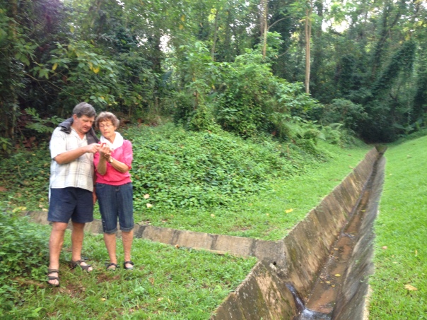
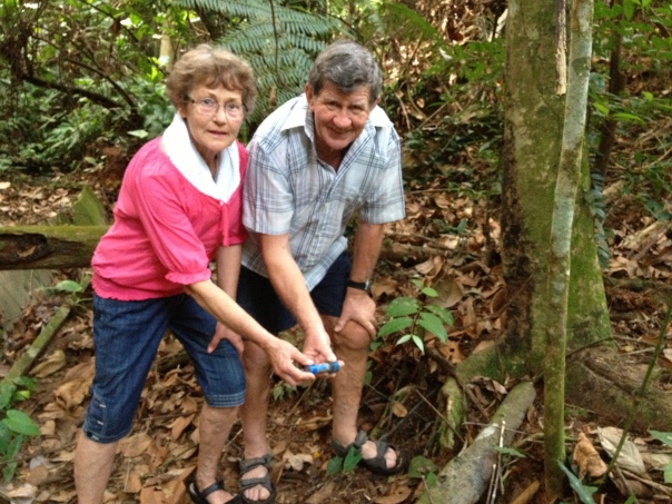
Mum and Dad checking out the GPS directions to the geocache.

Mum and Dad checking out the GPS directions to the geocache.

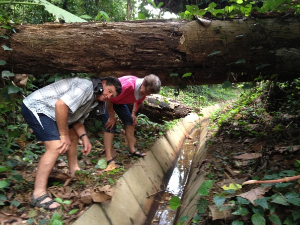
Mum and Dad were in charge of the navigation and very quickly got the hang of following the bearing and distance to navigate to the geocache. There were a few disagreements as to the best route to take especially when we came to a patch of jungle and the GPS indicated the geocache was 100m inside. We eventually followed a tiny trail beside a stream up through the jungle. Crossing under fallen trees and pushing through the undergrowth we eventually came to a junction in the stream. The GPS indicated this was the spot. The clue for the geocache read it was under a the roots of a tree.  Dad soon spotted the geocache after a quick hunt around. it turned out to be a small blue tube tied to the tree. Inside was a piece of paper which was the ‘log’. People who had found the geocache previously had recorded their names on this and the date they found it.  You always leave the geocache how you found it, so we noted our names on the log and returned it to its position.

Heading into the jungle

Heading into the jungle

Success! Mum and Dad with their first geocache find.

Success! Mum and Dad with their first geocache find.

The amazing thing about geocaching, is that there are millions of them hidden all over the world. In Singapore alone there are hundreds of geocaches hidden all over the island.  You don’t realise it but you will be walking over,under or past them every day. And in the pursuit of locating a geocache, you get some good exercise (without thinking about the fact you are exercising), get taken to new spots you would normally not visit and have an adventure. Give it a go!

This blog is listed under a section on my website called ‘Microadventure’.  Microadventures are cheap simple adventures close to home. A chap named Alistair Humphreys coined the phrase ‘microadventure’, you can read about him here.  I will continue to add more microadventures to my website to give people idea’s and inspiration to go on your own adventures.  If you do go on your own, I would love to hear about them and do drop me a line!

A failed microadventure – Kayaking SAFYC to Sentosa

A great thing about microadventure is that we get to experience so many new parts of Singapore we have never visited before.

So last Sunday  morning Stephanie and I opted to try to paddle from SAFYC (the Singapore Armed Forces Yacht Club) all the way down the east coast to Sentosa Island.  This would be the longest paddle yet at 25km distance.  We humans sometimes think we are a little more important in the bigger scheme of things than we really are.  Maybe we are doing well at work, sport, academically, artistically, financially or whatever it is that makes us feel 6 feet high and bullet proof.  We only need to pop outside and try something in the great outdoors which mother nature is not in the mood for us to do, to realise our true size and importance on the planet.  We are actually tiny grain’s of sand in a huge, huge universe. All very humbling.

So to cut a long story short – even though we planned the tides and currents to have them working in our favor – the wind was blowing in the opposite direction.  It whipped the sea up into a choppy mess.  We battled for 10km, being blown backwards every time we stopped paddling ad the Divorce Machine filling constantly with water before we called it a day.  We refueled at the Manamana restaurant on the east coast with vanilla milkshakes and fish and chips.

So in the end not a success but we still had great fun and spent a quality 3 hours together as a husband and wife enjoying being ‘out there’.

As the great man Winston Churchill said:  “Success is stumbling from failure to failure with no loss of enthusiasm.”

Captain of the Divorce Machine setting her up at the SAFYC.

Captain of the Divorce Machine setting her up at the SAFYC.

P1010753

Ready to roll at at the SAFYC.

Passing the Tanah Merah Ferry Terminal

Passing the Tanah Merah Ferry Terminal

A windy paddle

A windy paddle

Coming down the east coast

Battling down the east coast – Bedok Jetty in the distance

Stephanie stops for a rest and a relaxing view along the east coast.

Stephanie stops for a rest and a relaxing view along the east coast.

Passing underneath Bedok Jetty

Passing underneath Bedok Jetty

P1010802

The end – we chose to bail out early at the Mana Mana beach club after 10km.

The route we took from SAFYC to Manamana

The route we took from SAFYC to Manamana

Inflatable sea kayaking microadventure: Sembawang beach to Changi beach

The captain of the Divorce Machine (my wife Stephanie) was unavailable to paddle yesterday so cabin boy Blair Spendelow was called in to fill the 2nd seat on the sleek inflatable dream machine.  The plan was to paddle from Sembawang beach down to Changi beach, checking out the small islands of Pulau Seletar and Pulau Serangoon on the way.  The tide was going out all morning which meant the current should he heading east. I was hoping this would push us along nicely and make for a relaxing paddle but it turned out to be quite hard work and the current seemed negligible most of the way and not of any noticeable assistance.

We arrived at Sembawang beach at 7:30am.  It was my first visit to this spot and what a beautiful little beach this is.  The weather was perfect and the sea surface was mirror smooth.  There are great views of the Johor Straits and Johor Bahru across the water.  We soon had the Divorce Machine setup and ready to go, complete with 2 litres of water each(I learnt my dehydration lesson from last trip around Changi about what happens when I don’t drink enough).

Cabin boy Blair Spendelow with the Div orce Machine checking the conditions frrom Sembawang beach.

Cabin boy Blair Spendelow with the Divorce Machine checking the conditions from Sembawang beach.

The paddle started out well and we made good time following along the coastline for the first 10km.  We then chose to cross the strait and paddle around the northern coast of Pulau Ubin.  Coming around the eastern tip of Ubin to Chek Jawa marine reserve the tide was so low that we had to make a large detour to get around the shallow water.  It’s a completely different experience paddling around here at low tide as compared to high tide.

The wind also picked up here and it was a slog to get across the strait to Changi beach.  The Divorce Machine also started taking on water in the choppy sea state. The newly purchased water pump came in handy and Cabin Boy Spendelow did a fine job on the bilge.  We pulled into Changi beach after 4 hours of paddling, a distance of 23km in total and the longest trip the little pleasure craft has made to date.  We packed up the boat on the beach and took a taxi back to Sembawang beach to pickup the car.

This is a really nice paddle with interesting coastline, calm water and nice views across the strait to Malaysia.  I will definitely plan to come back and explore the Islands more in the future.  Enjoy the photos below.

Map of the route from Sembawang beach to Changi beach.

Map of the route from Sembawang beach to Changi beach.

We met Robin - a kayak fisherman in his very cool inflatable kayak. It was peddle powered and he even had an electronic fish finder.

We met Robin – a kayak fisherman in his very cool inflatable kayak. It was pedal powered and he even had an electronic fish finder.

The conditions were smooth and perfect for paddling for the first 10km.

The conditions were smooth and perfect for paddling for the first 10km.

We stopped at Punggol jetty for a quick stretch.

We stopped at Punggol jetty for a quick stretch.

Cabin boy Blair Spendelow took this shot with his GOPRO waterproof camera.

Cabin boy Blair Spendelow took this shot with his GOPRO waterproof camera.

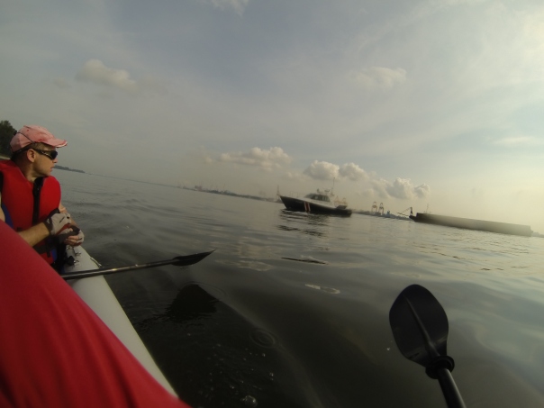
We watch them, they watch us. The Coast Guard came by to check us out. (Photo credit Blair Spendelow)

We watch them, they watch us. The Coast Guard came by to check us out. (Photo credit Blair Spendelow)

Crossing the Johor Strait to Pulau Ubin.

Crossing the Johor Strait to Pulau Ubin.

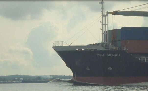
Love the bow wave of this vessel which steamed past it at a fair rate of knots in the Johor Strait.

Love the bow wave of this vessel which steamed past it at a fair rate of knots in the Johor Strait.

Cabin Boy Spendelow working hard on the bilge pump.

Cabin Boy Spendelow working hard on the bilge pump.

We saw a number of these beautiful birds, they are very elegant and have long legs and for some reason remind of me Gwyneth Paltrow.  If anyone knows the name of these birds please let me know.

We saw a number of these beautiful birds, they are very elegant and have long legs and for some reason remind of me Gwyneth Paltrow. If anyone knows the name of these birds please let me know.

I jumped out for a wee swim in the Johor Strait and took this photo of Blair.

I jumped out for a wee swim in the Johor Strait and took this photo of Blair.

The tide was so low we had to paddle a long way off Chek Jawa Marine Reserve on Pulau Ubin.

The tide was so low we had to paddle a long way off Chek Jawa Marine Reserve on Pulau Ubin.

The end is in sight! Changi beach in the distance.

The end is in sight! Changi beach in the distance.

This blog is listed under a section on my website called ‘Microadventure’.  Microadventures are cheap simple adventures close to home. A chap named Alistair Humphreys coined the phrase ‘microadventure’, you can read about him here.  I will continue to add more microadventures to my website to give people idea’s and inspiration to go on your own adventures.  If you do go on your own, I would love to hear about them and do drop me a line!

Sea kayaking microadventure – Changi Village to the East Coast SAF Yacht Club

When the alarm went at 6am on Saturday morning, neither myself or Stephanie were feeling particularly energetic.  After a few minutes lying in bed procrastinating we got up, loaded our inflatable kayak (a.k.a ‘The Divorce Machine’) into the car and set off on our morning microadventure.

The plan  was to paddle from Changi beach all the way down past Changi Airport and Changi Naval base to the East Coast parkway.  During pre-planning I knew low tide was at 0653 and high tide was around 1320hrs but I was uncertain exactly what the currents would be doing around this complex area of coast.  Our route following the coastline would take us in easterly, southerly and westerly directions.  After last weeks struggle in the strong currents, wind and a thunder-storm to get back from St Johns Island to Sentosa (click here to read about that), I wanted to try to work the currents more to our advantage for future kayaking trips.

The morning was calm and perfect for paddling as we parked beside the Changi Ferry Terminal and set-up the Divorce Machine.  We are getting faster at setting her up and in 15 minutes set off paddling at 0720hrs.  We followed closely to the shoreline as we headed out in the direction of a very narrow spit of reclaimed land called ‘Changi Finger’.  I had been told the current speed picks up to a very high-speed coming around ‘Changi Finger’ (in the order of 3+ m/s depending on tide) and to be careful in this area.  So I was a little nervous at how we would manage getting around the tip of the finger.

Stephanie prepares the "Divorce Machine' on a beautiful morning on Changi beach.

Stephanie prepares the “Divorce Machine’ on a beautiful morning on Changi beach.

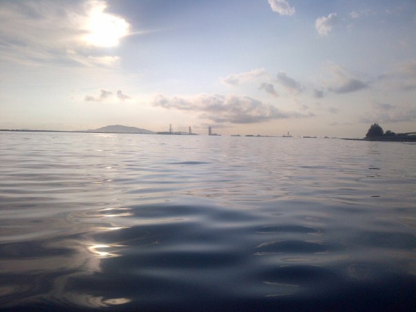
Beautiful flat conditions initially as the sun rises and we head towards Changi finger. The land visible on the left of the photo is the South Eastern coast of Malaysia.

Beautiful flat conditions initially as the sun rises and we head towards Changi finger (right hand side coastline). The land visible on the left of the photo is the south-eastern coast of Malaysia.

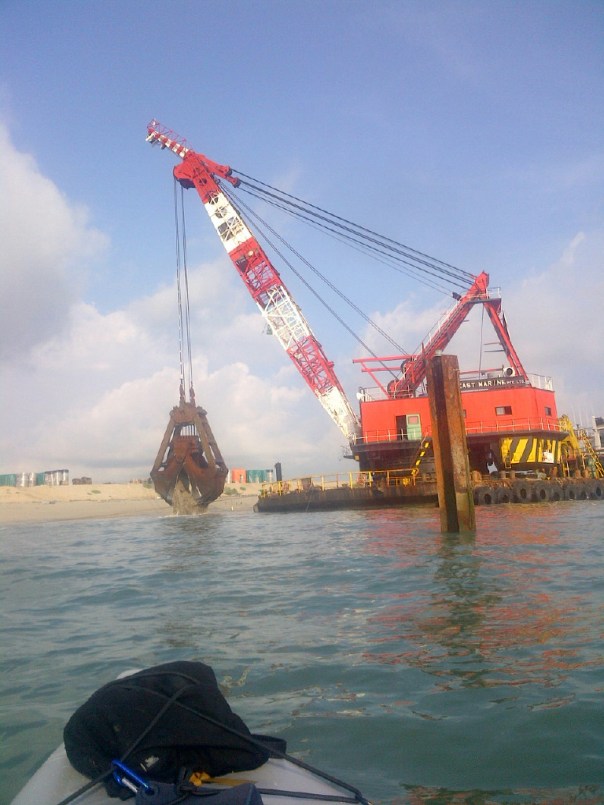
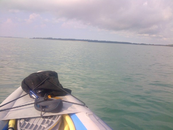
It’s over 5km of fairly boring paddling to get out to the end of Changi finger.  We took a rest beside a large clam-shell dredger which was working digging up huge mouthfuls of sand.  Up until this point staying close to the shoreline, the current speed had been negligible.  But rounding the tip of Changi finger the sea was a bubbling mess as the currents collided.  We had to paddle as hard as we could to get through this section as the Divorce Machine twisted and bucked in the waves.  Gradually the currents eased off as we got further away from the tip of the finger.  Next we had a large bay to cross  to get to Changi Naval base.  Crossing this turned out to be a real slog.  We took the shortest route, a 6km straight line which took us far from the shore.

This huge dredger was working at the end of Changi finger

This huge dredger was working at the end of Changi finger

Now I don’t want to be one to point fingers however being in the front seat, I was not sensing a great deal of paddling input coming from the skipper of the Divorce Machine seated behind me.  Stephanie later admitted she was feeling really tired and had been having a few ‘rest breaks’.  To make things harder, the currents in the bay go in two opposing directions.  The first 4km we were paddling into the current.  This was exhausting and I began to get really tired.  I paddled for 100 strokes at a time then rested.

IMG-20130413-00034

As we crossed the bay we came along way offshore – its 6km hard slog to reach Changi Naval base just visible way out in the distance.

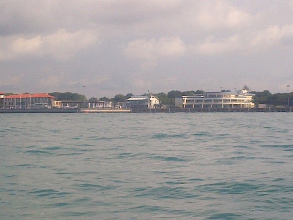
We finally got close to the Changi Naval base where the currents reverse direction and the going got easier.  As we rounded the south-eastern tip of Singapore Island and the long break water of Changi Naval base, the sea became choppy and the Divorce Machine started taking on  water.  When she is dry she glides through the water like the  S$2000 dream machine she is.   However when she takes on water she behaves more like a pregnant bathtub and becomes hard work to paddle.  We had also forgotten to bring a container or sponge to bail her out with so Stephanie used our water bottle to attempt to empty some of the water. We finally got around the choppy waters of Changi Naval base and started to head west with the currents towards the east coast of Singapore.  By this stage we were both really tired.   The day was starting to get very hot with the sun blazing and glaring off the water.  I had not drunk enough water and had a splitting dehydration headache.   The SAF yacht club was a welcome sight as the first point in a few km where we could get into shore safely.

The red colored roof of the SAY Yacht club in the distance was a welcome sight.

The red colored roof of the SAF Yacht club in the distance was a welcome sight.

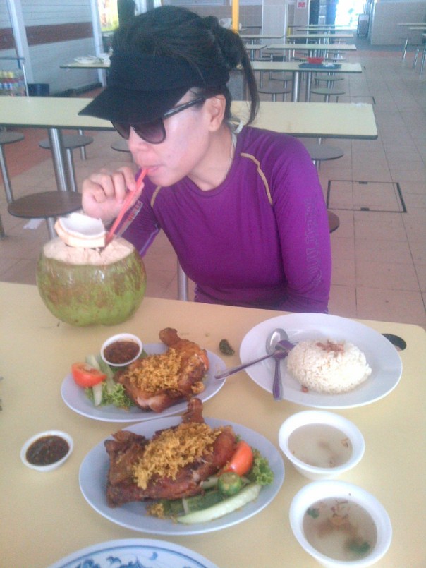
We gratefully and slowly paddled in and ended the voyage here.  Even though we only paddled 13.6km, it took 2 hours and 50 minutes and was tiring working against the currents.  I was feeling completely knackered and well in need of some food and drink.  We deflated the Divorce Machine here, loaded  her into a taxi and headed back up to Changi beach car park to pick up the car.  I started to feel a little normal again after powering down a beautiful plate of Ayam Penyet (Malay style fried chicken) and drinking a fresh coconut in Changi Village hawker centre.

The skipper of the Divorce Machine refuels at Changi Village hawker centre.

The skipper of the Divorce Machine refuels at Changi Village hawker centre.

We both agreed that the Southern Islands and Pulau Ubin paddle are more scenic than this area of coastline.  It is a good trip to build paddling fitness.  In the future I plan a longer paddle and to finish another 12 km down the East Coast at Mana Mana.  This would make a trip of 25km in total.

Map of route

This blog is listed under a section on my website called ‘Microadventure’.  Microadventures are cheap simple adventures close to home. A chap named Alistair Humphreys coined the phrase ‘microadventure’, you can read about him here.  I will continue to add more microadventures to my website to give people idea’s and inspiration to go on your own adventures.  If you do go on your own, I would love to hear about them and do drop me a line!

Maiden voyage of The Divorce Machine – a kayaking micro adventure from Changi to Pulau Ubin

After living for almost 15 years on this beautiful tiny little Island, Singapore yet again surprised and delighted me this morning.

The story actually starts some weeks back.

A wise man once said “Every man wants three things in life, beautiful woman, the company of good friends, and an inflatable kayak”.  (I just made that up but I am sure wise men would say stuff like that).

So it was with much anticipation and excitement three weeks ago that I took delivery of my brand new Sea Eagle Fast Track Inflatable Sea Kayak, mail ordered from the USA and delivered to my office as it was too large to fit in my home post box.

I lumped the 3 large boxes into my car and ferried them home and set about setting up the paddles and inflating the kayak in the small lounge of our 1000 sq foot apartment.  I had deliberately kept the purchase of this little pleasure vessel a secret from my wife Stephanie as I wanted to surprise her. (A secondary reason was that I knew she may stop me doing it).

Surprise! Trying out 'The divorce machine' in the lounge.

Surprise!!!

It definitely did turn out to be a surprise for her when she came home and found me sitting in the inflated kayak in the lounge watching television.  In fact she was so surprised she made me pack it up immediately and get it out of the lounge before I smashed the glass ranch slider with my paddle.   After my few pre-prepared lines such as “Its got two seats, one for you and one for me” and “god you look beautiful when you are angry” did not seem to enable her enthusiasm for the purchase, I resigned myself to the fact that I would have to get her out on an adventure to prove just how much of a good idea this whole thing actually was.  All Stephanie seemed concerned about was tiny little details such as  ‘where are we going to store it?’ and ‘how are you going to clean it?’ and ‘what will you do it when it gets a hole in it when you are in the ocean?’.  All things I had never actually thought about to be honest.

After completing our ‘1 star kayaking course’ two weeks previously with the lovely people from Xtreme kayaking (I strongly recommend them if you want to learn how to kayak as they are very patient and run professional, well taught courses at Manamana on East coast parkway), we ventured to Changi Village on Easter Friday morning and set out on the maiden voyage.  During the 1 star kayaking course, our inflatable kayak has been fondly  christened ‘The Divorce Machine’ by good friend Mr Blair Spendelow.  Stephanie seemed to think the name was quite appropriate.  So I decided to stick with it.

Pumping up 'The Divorce Machine' at Changi beach carpark.

Pumping up ‘The Divorce Machine’ at Changi beach car park.

The plan was to start at Changi beach, and paddle ‘The Divorce Machine’ across the Singapore straits, and around the eastern half of Pulau Ubin (an island located just off the North East coast of Singapore).  Pulau Ubin means ‘Tile Island’ in Malay.  This is because of the granite that was quarried from the island and used for building purposes on the Singapore mainland.  The granite quarries closed in the 1960’s and the island has since become one of the few placed in Singapore where you can experience a relaxed kampong (village) atmosphere in some beautiful natural surroundings.

After some extensive research and pre-planning (2 minutes on the computer checking the tide tables and a quick sketch on a piece of paper to work out the currents the day before), my calculations showed that high tide would be around 12:26PM, and we could therefore do a counter clockwise loop around Pulau Ubin, paddling with the current as we headed west, then cut straight down through the island through the river mangroves as we reached high tide then could paddle back across the strait to Changi Beach in a south easterly direction with the current as the tide started to go out. (The current direction in Singapore is directly related to the tide, when the tide comes in, the current flows to the west and vice verca).

The Singapore strait happens to be a very busy shipping channel, with some very large boats and very many ferries travelling very fast which all made me very nervous paddling very slowly in a very small rubber kayak filled  with a very small amount of air laden with a very precious cargo (i.e. my wife).  However the water surface was calm and with no wind it was ideal conditions for paddling.  We set off at 10AM and crossed the channel in between tug boats pulling huge barges full of sand, large merchant vessels and many smaller ferries. Stephanie even seemed to enjoy the excitement of dodging these huge vessels.

Some of the things we decided to give way to in the Singapore Straits

Some of the things we decided to give way to in the Singapore Straits

Here we paddled around the perimeter of an area known as Chek Jawa.  Chek Jawa is a marine reserve and full of rich bio diversity.  I had read the day before that it is possible to see dolphins in Chek Jawa.  We were having a small rest from paddling and enjoying sitting in the boat when suddenly only 10 feet from the boat something surfaced and let out a whoosh of air.  It scared the crap out of both of us, “what was that?!” Stephanie squeaked in alarm.  “It must have been a dolphin” I excitedly shot back.  I couldn’t believe our luck!  We eagerly scanned the water  surface for the next few minutes to see if we could spot the creature again but alas it was not to be.  Since coming home I have done some research online.  It may have been a dolphin or a dugong, it is hard to say as we did not get a good look at it.  I would love to hear from anyone else who reads this, if they have had other similar experiences.
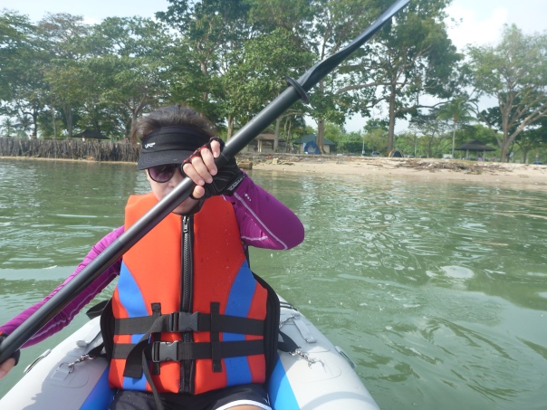
We set off leaving Changi beach behind.

We set off leaving Changi beach behind.

The beauty of Chek Jawa's rocky foreshore. A rich ecosystem and one of the last natural rocky shorelines in Singapore

The board walks along Chek Jawa’s rocky foreshore. These help protect the rich ecosystem and one of the last natural rocky shorelines in Singapore

We continued our way around the island.  It was a beautiful morning for kayaking, slightly overcast which meant it was not to hot and glary.  I marvelled at the beauty of the rocky shoreline of Chek Jawa.  I could not help but wonder why I had never visited this area in 15 years of living in Singapore.  As it turned out the day just kept on getting better and better.  My current and tidal predictions turned out to work out about as perfectly as I could have hoped for.  We moved easily with the current around the northern end of the island.  Here there is a fence along the rocky shoreline – I presume to stop people swimming in from Malaysia?  There is also quite a lot of garbage floating in the sea.  My view on this is that instead of moaning about it, if everyone picked  a bit up then the situation would naturally improve.  We ended up picking up a large bag full of plastic bottles, wrappers and all sorts of bits and pieces which we took back to a rubbish bin on Pulau Ubin.

We paddled on past some floating fish farms or ‘kelong’ in Malay (not sure if I spelt that correctly so please do comment if I am wrong).

A 'Kelong' or floating fish farm.

A ‘Kelong’ or floating fish farm.

Finding the mouth of the river was interesting as from a distance the entire shoreline looks fenced.  It is not until you get closer up that the entrance to the river is apparent where there is a gap in the fence. Once in the mangrove system, the scenery changed completely.  The tide was pushing hard up the river so we floated along with a few easy strokes every now again to keep direction.  Stephanie at this point became a little concerned about the presence of crocodiles.  Every log and stick floating along in the murky water soon took on the resemblance of a crocodiles head and our minds raced with wild thoughts.  I tried to sound confidently reassuring to Stephanie by informing her the only wild crocodiles in Singapore were a few km further west in the Sungei Buloh nature reserve.  But I do admit wondering to myself – if they are up there, then why are they not down here?!
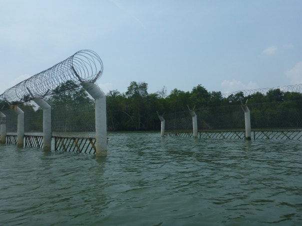
Finding the whole in the fence to access the mangroves and the river mouth entrance

Finding the hole in the fence to access the mangroves and the river mouth entrance

Paddling through the mangroves - I imagined we could have been in the Amazon!

Paddling through the mangroves – I imagined we could have been in the Amazon!

The scenery was beautiful though and was we followed the many twists and turns of the river, not a sight or sound of another soul, just us, the river and the mangroves lining the banks.  I imagined we could have been anywhere in the world. Floating down the mighty Amazon in South America even.  From the small map I had printed the night before, I knew we had a short portage (portage means carry the kayak) of a few hundred metres to access the river system draining south through the island.  I popped the divorce machine on my head and headed off while Stephanie carried the paddles and other bits and pieces.  Soon we were in the second section of river and were paddling out into the Singapore Strait on the south side of Pulau Ubin, heading back for Changi beach.
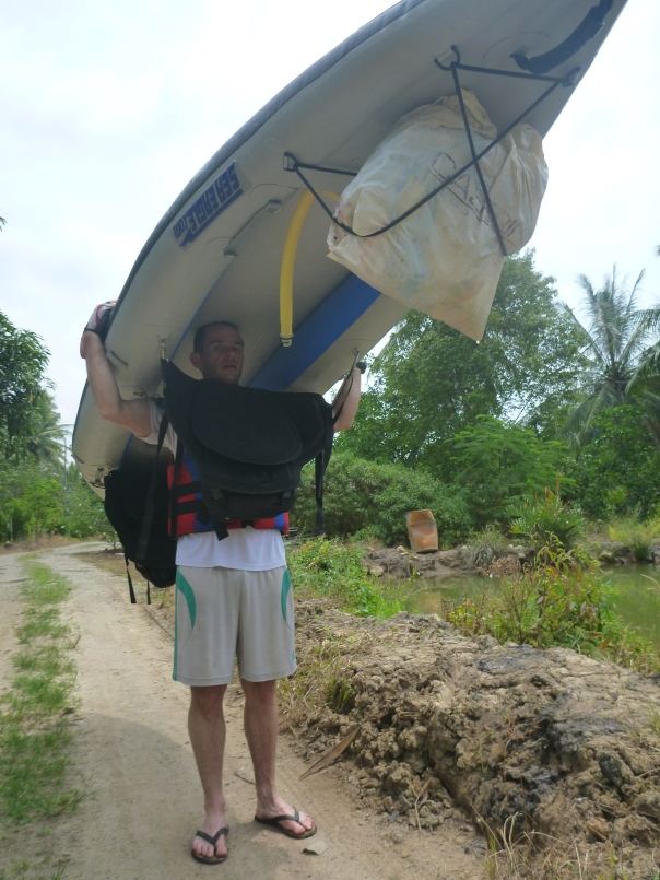
Carrying the divorce machine on my head for a short distance across the interior of Pulau Ubin.

Carrying the divorce machine on my head for a short distance across the interior of Pulau Ubin.

By now the wind had picked up, the tide was going out, and the current had reversed direction.  The shipping channel was busier and the wind and the ship wakes caused the swell to pick up.  It was great fun and even felt a little exhilarating as we paddled hard in between breaks in the vessel traffic to get across to the mainland side.   Here we had a relaxed paddle following the coast back down to Changi beach where we had a well deserved swim.  I mapped our route using GPS  and the RUNTASTIC application on my blackberry phone.  We paddled just over 17km and it took a total of exactly 4 hours.

The great thing about an inflatable kayak is they are so portable.  Back at the car park, I simply deflated the boat and rolled it up and stuck it in the boot.  This took no longer than 15 minutes.   My first impressions of ‘The Divorce Machine’ after her maiden voyage are really very positive. She tracks in a straight line very well.  She is very stable even in boat wakes and larger swells. She is made of tough material that seems very hard to puncture, and is fast to set up and pack up.   The biggest bonus of all – Stephanie loved the trip!

We are really looking forward to more kayaking exploration and adventures over the next few months.  Happy Easter and may you also have some exciting adventure to put some sunburn on your body, a smile on your face and some happy memories in your heart before you go back to work on Monday!

Stephanie arrives back at Changi beach after completing the maiden voyage of 'The Divorce Machine'

Stephanie arrives back at Changi beach after completing the maiden voyage of ‘The Divorce Machine’
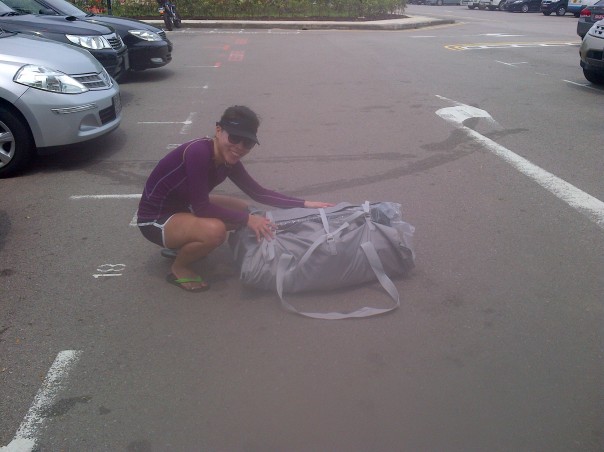
'The Divorce Machine' all packed up in 15 minutes flat fits into this fairly small bundle.

‘The Divorce Machine’ all packed up in 15 minutes flat, fits into this small bundle.

Map Pulau Ubin

Our approximate route around Pulau Ubin, 17km and 4 hours paddling time in total.

This blog is listed under a section on my website called ‘Singapore Micro Adventure’.  Micro adventures are cheap simple adventures close to home. A chap named Alistair Humphreys coined the phrase ‘micro adventure’, you can read about him here.  I will continue to add more micro adventures to my website to give people idea’s and inspiration to go on your own adventures.  If you do go on your own, I would love to hear about them and do drop me a line!