Blog Archives

Peak to Peak 2015 – The movie – climbing the Dragon Horns

Instead of a lengthy blog post,  I created this short video of the awesome adventure we finished last week – Peak to Peak 2015 the  movie – ENJOY!

Sea, salt and sex pegs!!!

Happy Monday morning folks – here in Singapore we are looking forward to Chinese New Year and a shortened work week ahead.  I celebrated the upcoming year of the goat (click here to read more about Chinese Zodiac signs) with a beautiful 24km paddle around an Island at the weekend – along with a friendly Singapore chap and two barking mad Australians.  We were lucky enough to see some beautiful wildlife, which got the Aussy’s especially excited – squealing in delight at the ‘sex pegs’ they saw running down the beach. (Literal translation “six pigs”).  Enjoy the short video made with my brand new GOPRO.

Three climbers missing on Mt Cook – may they have the strength to weather the storm

After the terribly sad news of the QZ8501 AirAsia disaster, I was alarmed to come across more bad news last evening regarding three climbers who are reportedly missing on Aoraki/Mt Cook (click here to read more).  They were reported to be climbing the Linda Glacier route to the summit of the 3754m – Aoraki/Mt Cook, New Zealand’s highest mountain.  As with most climbing parties who climb Mt Cook – it seems they left Plateau Hut in the early hours of the morning, to make the most of the cold morning conditions (freezing the snow making it easier for travel) and under normal circumstances should have been back to the hut by evening time. They have since failed to return to the Plateau Hut sparking the Search and Rescue efforts.

The Linda Glacier route to the summit of Aoraki/Mt Cook is a route I know well, having attempted it three times and succeeded twice – most recently in December 2013 during our Peak to Peak expedition from the summit of Mt Ruapehu to the summit of Aoraki/Mt Cook completely by human power.  Climbing Mt Cook, from Plateau Hut by the Linda Glacier route is a massive day, my first attempt in 2009 took us 19 hours for the round trip and in December 2013, it took us 21.5 hours to reach the summit and get back down.

There have been some factually incorrect press statements and diagrams of the route released (which is nothing unusual) – however to get an idea of what the actual route is REALLY like I made a 3-d fly though in Google Earth which you can view in Youtube in 3 minutes below:

There are a number of possible scenario’s that may be unfolding now.  I will not speculate on what may have have happened to the team, suffice to say I am optimistic that these guys may still be ok.  The best case scanario is that due to what ever reason they have been delayed, hopefully they will have found shelter from the storm in a suitable crevasse or snow hole in the Linda Glacier or on the Linda Shelf, of which there are many.  It is possible to be caught out, and survive terrible weather on Mt Cook, I have been in this situation myself. Together with Alan Silva we were attempting to climb the Grand Traverse route on Mt Cook in December 2012.  We got caught on the Hooker Glacier (the opposite side of Mt Cook to the Linda Glacier) and spent a very wet and cold night sheltering from intense wind and rain in a crevasse which we dug out further into a small snow cave.  Whilst not a comfortable evening, we were cold and frost nipped but relatively unscathed the next morning, and were able to make our retreat (you can see a small Youtube clip below about our evening).  Admittedly we were much lower down the mountain than these three chaps but similar survival stories are not uncommon through the years – one of the most notable being Mark Inglis and Philip Doole who were stuck very high on the Grand Traverse route for 13 days in 1982.

You can also see an interactive model in Google Earth showing the route we took up the Linda Glacier as tracked in real time by a satellite tracking system here. Be sure to choose the map overlay as GOOGLE EARTH on the left hand side of screen to see it in 3D.

I am still at this stage very optimistic for these three gentlemen. It is very important to remain positive.  As with all fellow climbers that I know, we venture into the mountains to become closer to life rather than to death.  Do join with me to send all positive energy in their direction.  All storms eventually pass – may they have the strength and endurance to weather this one.

(For a description of the climb from Plateau Hut to the summit of Mt Cook up the Linda Glacier route, click here to download an excerpt from my recent book From Peak to Peak).

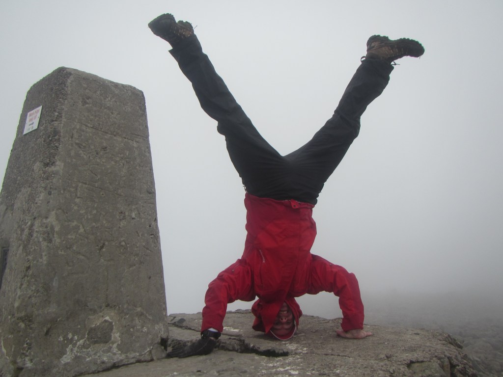
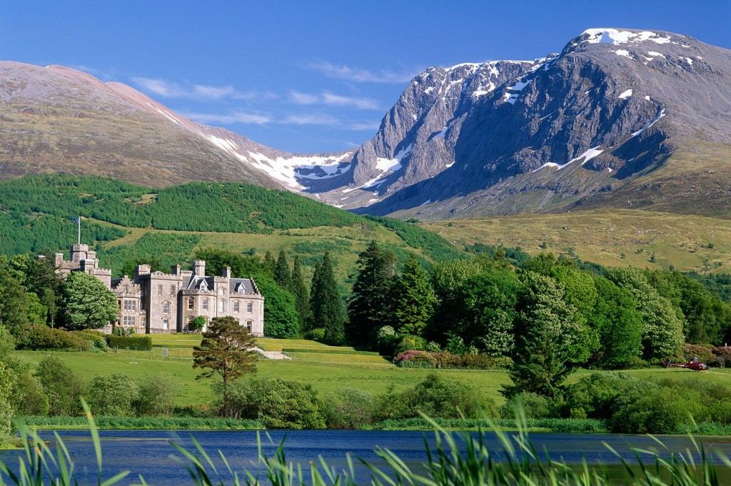
Peak to Peak 2014 – Ben Nevis to Mt Blanc – Trip report with images

Ben Nevis to Mt Blanc – by human power

From the summit of the highest point in the UK, to the summit of the highest point in France. That was the plan that Alan Silva and I had and we attempted this mission in a similar style as the previous years highly successful Peak to Peak 2013 trip from the summit of the North Island of New Zealand to the summit of the South Island. With as little support as practically possible. on a shoe string budget (less than S$2000 each) and fitting into our annual leave.

This is a consolidated report of the entire expedition, complete with photos and a summary of the top highlights, lowlights, and the lessons learnt from the journey.  I have tried to keep it shorter rather than longer for readability and have included lots of photo’s!

We always knew that the realistic chances of completing this journey would be very slim. I get 20 days annual leave per year and I used 18 of these days for this trip. Combined with the three weekends, meant I had 24 days in total. This included flying time from Singapore to Europe (and return) to complete the 2000km journey. This constraint on time meant that not only would we have to keep moving every day, but also we had almost no time to wait out bad weather. Something that any outdoors person knows is not the ideal situation to be in when you are attempting to climb large icy things or paddle wide, swift watery things. Cycling in the rain though was not too much of a problem – it’s just miserable, cold, mind numbing and at times a little dangerous.

We left Aberdeen on a cloudy overcast day, and were privileged to be driven the 5 hour car journey to Fort William by the legendary Bill ‘the Bonnie Scotsman but still part of England’ Stuart. I had been monitoring the weather forecasts and it was very apparent that our original ‘window’ for climbing Ben Nevis over the Saturday and Sunday 16/17 August was not looking good. High winds and lots of rain, were being swept through in a series of low pressure weather systems (I later found out this is considered normal weather for Scotland). So we made an executive decision to rip up to the summit that very Friday afternoon, rather than risk the chance of being stuck for two days waiting out bad weather over the weekend and getting behind schedule right from the word go.

After we ‘touched down’ in Fort William (i.e. Bill let us out of his car) we pulled on our walking shoes, bought a cheap paper map and headed off up the tourist trail with hundreds of other daring adventurers. Dogs, cats, small children, large children, fit people, unfit people, people in sensible clothing and people in ridiculous clothing more suited to a hot yoga class than a stroll up a mountain where the weather can turn quickly enough that it catches people out and kills almost every year.

With Alan Silva at the tourist information centre at the base of Ben Nevis, fresh faced and full of beans as we are about to start the wander up Ben Nevis.

With Alan Silva at the tourist information centre at the base of Ben Nevis, fresh faced and full of beans as we are about to start the wander up Ben Nevis.

Alan had I did not want to follow the tourist route however – we had our eyes and our plans set on the Tower Ridge which ascends the North Face of Ben Nevis. This is a full-on rock climbing route and we had bought harnesses, rope and the necessary climbing kit – however owing to our late start in the afternoon we decided that we probably did not have enough time to complete the route before darkness and opted for a variation known as the CMD arete. (Thanks to a friendly and helpful chap named Rob who suggested this).  This route follows a large curving ridge around the North side of Ben Nevis – far away from the crowds. It is considered a scramble, rather than a rock climb, and turned out to be a really enjoyable walk, however we both looked up with considerable disappointment at the beautiful Tower Ridge as we passed underneath it. I tucked it away firmly into my ‘things to do in the future’ list (don’t forget Rob and hopefully you will join!).

Alan Silva on the way up the tourist track.  We turned off this half way up and snuck around the North side of the mountain to follow the CMD arete.

Alan Silva on the way up the tourist track. We turned off this half way up and snuck around the North side of the mountain to follow the CMD arete.

IMG_2124

The Tower Ridge on Ben Nevis – centre of photos, leading to the summit in the clouds

Alan Silva wandering around the CMD Arete

Alan Silva wandering around the CMD Arete

Pulling a headstand on the summit in the cloud.

Pulling a headstand on the summit in the cloud.

Video from the summit of Ben Nevis:

After an enjoyable few hours we reached the top of the Ben at 5:00PM’ish. It was cloudy and cold on the summit, we took photo’s and video and I began to shiver after just a few minutes. There was very little to see due to the cloud so we soon set-off down, this time we followed the tourist trail. Two hour later we were back down in the carpark and met Bill wandering up the path to us. We spent an enjoyable night as the rain came in, celebrating with a cheeky beer or two and a relaxing dinner at the pub.

The next morning was wet. That rain the forecasters were talking about came rolling in. We were spoiled rotten by Bill once again. He cooked, cleaned and looking after us in royal fashion. Several cups of tea and a plate of delicious bacon and eggs later, we forced ourselves out into the rain and loaded up our bikes for the ride south. Here me made another executive decision. We had initially decided to carry all our climbing gear for the Mt Blanc climb on our cycles. Crampons, plastic mountaineering boots, snow stakes, ice screws, ropes etc. Bill kindly offered (and we readily accepted) to put this gear into a box for us and post it to Rye Harbour on the South Coast of England where we could pick it up as we paddled over the channel.

Back down after our successful oxygen-less, unsupported ascent of the CMD arete on the Ben Nevis with this lovely man - Bill Stuart

Back down safely after our successful oxygen-less, unsupported ascent of the CMD arete on Ben Nevis with this lovely man – Bill Stuart, a great ambassador for Scottish people.

Off we set in the rain. I got 15 metres only before realising my front wheel was back to front and we had to stop and refit it. Back on the bikes we followed the shore of Loch Eil southwest for two hours until we reached the Glencoe valley. I was excited to ride through this amazing valley – having walked through it many years previously on the West Highland Way.  However the rain and cloud obliterated much of the view. Some other factors also made it very interesting. It was a longgggg uphill for around 20km, the holiday traffic was intense, the rain was bucketing it down and there was no road shoulder to cycle along the single carriageway road. Concentration was required for hour after hour as we slowly ground our way up and over the Scottish Highlands, peddling along with traffic passing us continually in waves of vehicles.  It was with considerable relief when we reached the top and started to cruise down the other side. The rain, cold and traffic was a shock to the system for the first days cycling, and we managed a meagre yet hard won 75 km before stopping, completely wet through at the small village of Tyndrum. I was carrying a tent, however in the pouring rain, it never is a nice option to have to consider so we dived into the pub and took one of their rooms for the evening. This set the standard for the entire trip and we never used my tent once, opting to sleep in cheap hotels or B & B’s at the end of the day. Especially when wet, it’s very nice to have somewhere to dry your gear at the end of the day and warm-up after you have been out in the elements for hours on end. And, even when it was not wet I used the possibility of rain as a convenient excuse to skip the camping option.

Alan cycles carefully along the non-existent road shoulder in heavy holiday traffic through the Glencoe valley

Alan cycles carefully along the almost non-existent road shoulder in heavy holiday traffic through the Glencoe valley

Over the next two days we rode down past Loch Lomond and right into the heart of Glasgow. Glasgow surprised me with its beautiful city centre and pedestrian mall full of colorful sights and sounds. I had expected a more industrial town, but it was exciting and energetic. We stayed in the Youth Hostel here and enjoyed an Indian meal followed by a slow wander back with Alan intrigued by every drain pipe, balcony and construction method he came across. He was in engineers heaven and I thought we would never make it back to our beds.

A short video from Loch Lomond below:

Alan at Loch Lomond - still raining.

Alan Silva, happy to be down at Loch Lomond in more beautiful Scottish weather

Alan Silva in downtown Glasgow

Alan Silva in downtown Glasgow

The next day we made it to Moffat – a beautiful little village close to the border of England.  Here I got my back sprocket fixed as my gears were slipping and jumping all over the place.  Alan was still hit with the flu so was feeling wiped out by this stage.  The next day we had a lunch break in Gretna Green (famous as a place for English to elope to marry in) before crossing the border and entering England. We stopped in Carlisle that evening at the home of Sally and Tim Sarginson. They were perfect hosts showing us around Hadrian’s Wall (it’s not very big so I don’t know how it kept anyone out), the Carlise international airport(I think they were having us on) and we also visited the pub which was becoming a common theme on the trip.

Checking out the Carlisle International Airport

Checking out the Carlisle International Airport

The following day we had a tough ride but my FAVORITE day of the entire trip – we cycled through the Yorkshire Dales and the Pennine ranges which are known as the ‘backbone of England’. The riding was up and down numerous hills with our highest elevation reached a paltry 600m, however continuous rolling hills made my legs start to burn and I was feeling relieved when we finally reached the village of Leyburn.  Alan struggled his way in – the flu really taking its toll on his energy levels – but as usual not a word of complaint.

Villages in England we noticed seemed to be built on top of hills, whilst in France they were at the bottom of valleys. I am not sure why, as both places have their strengths and weaknesses (e.g. water/defence), however if anyone knows do leave a comment here to explain! It was a beautiful days riding though. If anyone ever wants to ride through a nice part of the UK – go to Yorkshire! Nice quiet roads, quaint villages and picturesque farmland scenery. The Tour de France had recently been through this part also so all the way along yellow bicycles were tied onto trees and hay bales, and the road was in great condition to cycle on. We happily dived into the pub in Leyburn for the night and enjoyed a good nights rest.

Traffic jams in Yorkshire are mainly from farm machinery

Traffic jams in Yorkshire are mainly from farm machinery

More Yorkshire scenery

More Yorkshire scenery

Cycling through Yorkshire - my favorite part of the trip!

Cycling through Yorkshire – my favorite part of the trip!

A nice sunny day as peddle through Yorkshire

A nice sunny day as we peddle south from Carlisle

A short video of Yorskhire

An overcast day welcomed us as we sped south the following day and we enjoyed lunch in Harrogate – a town popular with tourists for its natural ‘spa’ and also its proximity as a gateway to the Yorkshire Dales.  That evening we made it to the industrial town of Doncaster. Doncaster reminds me of a terrible joke that David Brent made in the TV series ‘The Office’. ‘A nuclear bomb was dropped on XXX and there was 15 pounds of damage’. You may substitute ‘XXX’ for ‘Doncaster’. As I found a place to stay, Alan was chatted up on the street by the bride of a wedding party. He was then later chatted up in the bar by a barmaid who ‘just loved his Australian accent’. He therefore probably has fonder memories of the place than I do.  It reminded me of being in a third world state.

With relief we left the next day and had a very productive day cycling over 120km to Boston almost on the east coast of the UK. Boston is a pleasant city and very welcome after the horrors of Doncaster. We had been very well behaved up until this stage of the trip – early nights and long day riding and I should have known something was about to happen. And happen it did as the next day we cycled further south to the horse racing capital of the UK, Newmarket. It was hot and sunny as we cycled into Newmarket, so we followed instincts and took shelter in the first pub we could find. Suitably refreshed with a cleansing ale – it started to rain and I was soon freezing cold. With burning legs we made our way  a few km more to the beautiful home of Mr Tony who kindly put us up for the night and we were invited to his daughter Kate’s – husbands surprise birthday. It was definitely a surprise for him seeing us turn up. Lets just say we had a great night and I almost had to cycle south alone the next day as Alan was falling for the local Newmarket ladies.

We were very lucky to stay with Tony here in his beautiful house in Newmarket.

We were very lucky to stay with Tony here in his beautiful house in Newmarket.

Passing some canals

Passing by some canals

Feeling decidedly sorry for ourselves the next morning – it was a slow day. But just when we needed some inspiration, it arrived in the form of a red haired, good natured, 100 kg, one-man, english entertainment system. AKA Ian Slack. Ian and his son Ben accompanied us all day on their bicycles, guiding us, feeding us, telling us stories, helping little old ladies across the road and passing me sweets as I grovelled my poor hungover, broken down carcass up hill after hill until we reached another town the UK will never be famous for: Brentwood. “Why the hell do you want to stay in Brentwood?” asked Barclay Morison, ex-rugby mate who came out with his bike to join us that evening. “Because I am tired, hungover and feel like a pathetic wimp who just wants to go to sleep” was the reason, however I fabricated another story about wanting to experience more off-the-beaten-track areas along our journey. The next morning it was raining – hard and as I ate my breakfast and looked up into the heavens above I noticed that it not only rains water from the skies in Brentwood but also used condoms. We informed the waiter and he dutifully sent someone up onto the roof to retrieve the offending item from the skylight where it was happily resting.

As I geared up to ride into and through the east part of London in the cold and the rain, Barclay took one look at my thermal layers, rain shell jacket and fluorescent vest before breaking into a long story about how soft I was. I think it was an attempt at payback for me telling the true story the previous evening of how he was once stretchered off the rugby pitch and whisked away by ambulance to hospital, only to miraculously recover 2 hours later and join us in the pub that evening. However his ribbing made me start to think I was maybe being a bit soft. Until we had cycled about 15 minutes when Barclays teeth started chattering and he started mumbling something about that was enough for the day and it was time for him to go home to catch up on some important admin jobs. Unfortunately the poor guy could not, as first Alan got a puncture then my entire back wheel blew out – ripping my tyre to shreds. In the pouring rain, Alan ‘McGyver’ Silva sewed my tyre together with needle and thread, good enough for me to ride to a bike store where I could buy a new tyre.

Barclay accompanied us to the Woolwhich pedestrian underpath, which allowed us to pass under the Thames river before we finally allowed him to leave us. As with Ian Slack, he was great value to ride with for the day and it was awesome to see familiar faces on the opposite side of the world when you are out and about.  I did feel a slight pang of envy knowing he would be home in one hour in the warmth and drying off, whilst we still had over 100km of up and down, through Kent, in the pouring rain that day to get to Rye Harbour.

Barclay getting cold as Alan fixes his puncture in the outskirts of London

Barclay getting cold as Alan fixes his puncture in the outskirts of London

The next few hours sucked. It rained, and it rained and it rained. My chain started playing up, it turned out to be the plastic chain guard which thankfully Alan fixed by cutting off and throwing away. The steep short rolling hills were non-stop. We followed tiny backcountry lanes which I had to use my GPS to route find – but in many places the reception was not good enough to use the GPS and we had to guess the way.  At 7PM that evening in the dark and the wet we rolled into Rye Harbour, after a really crappy day in the saddles, but happy to have finished the UK cycling leg.

Or so we thought -as the next day we realised we were starting our paddle from Dungeness beach – still 25km away. It rained again as we cycled out to Dungeness, and returned to Rye Harbour – our rest day in Rye Harbour turned into a 55km ride in the pouring rain, wet-through once again.  Dungeness beach is a wind-swept barren place, with two huge nuclear power stations standing stoically as great square fortresses, visible from miles.

The shot 50 second video below gives an idea of the area.

Now using support boats or vehicles was not something that Alan and I wanted to do for this trip, however kayaking the English Channel is something that is actually very difficult.  Not due to mother nature, but more due to the restrictions imposed by the French Coastguard who do not allow ‘unorthodox crossings’ of the English channel, by non-powered vessels like kayaks.  Swimming is ok though.  Yep, thats right. As crazy as it sounds.  I had approached many organisations for permissions to cross the channel starting with the French Coastguard who said ‘NO’.  And one-by-one the rest of them said ‘sorry the French control it so we cant help either’.  So we reluctantly settled for second best.  Using   a support boat, and paddling most of the way across, but exiting the kayaks and getting into the support boat to motor across the 5 – 6 nautical miles of the French Shipping Lanes.  In my view. if we had to take non-human powered transport for 2 metres of our journey it spoiled the spirit of the trip, so 5 – 6 nautical miles was just sickening and it still makes me froth at the mouth as I write this.

We departed in the kayaks along with our friendly support boat from FULL THROTTLE at 11:30AM to time the tides so that there was enough water in the Rye Harbour for the support boat to get out.  The tidal range is over 6m in this area and the currents subsequently very strong.  The English Channel is like a river, with the current flowing one direction with the tide, then turning in the opposite direction every 4 – 6 hours.  The day was overcast with visibility of less than 2 -3 miles when we started and we soon last sight of the mother England after only 45 minutes paddling.

Having a support boat for this crossing took 99% of the adventure out of the paddle for me.  There was no need to navigate as we simply followed the boat – about 100m in front of us.  The knowledge that if we fell out or had a problem then safety was so close in the form of a RIB with over 200 HP waiting to gun us back to safety, completely ruined the fun.  I resigned myself to sitting in the boat and padding for 60 minutes then stopping for a 5 min rest on the hour – with nothing of much interest to see at all, no land, very few ships and dirty muddy water without any sign of fish.  We repeated this cycle for three and a half hours until we hit the middle of the channel.  We made good time at 3.5 – 4 knots, then exited the kayak and motored over the French shipping lane. re-entered the kayaks about 7 nautical miles from Boulogne in France and paddled the last three hours into Boulogne harbour, fighting some current this time and pulling into the beach in the harbour after 6 hours of paddling.  I was not in very good kayaking fitness and I was happy enough to stop paddling by now.  I calculated we paddled around 20 nautical miles, and motored the rest.  We saw a few large ships far out into the distance but the channel really is quite wide and we never got very close to any at all. The sea state  was choppy and it felt more like being in a small pond than out at sea. No rolling swells coming through like we felt the previous year in the Cook Strait.  Some parts we paddled over were only 3 – 4 m deep – whilst the average depth seemed to be 20 – 40m.

Alan Silva somewhere in the English Channel

Alan Silva somewhere in the English Channel

Grant Rawlinson, somewhere in the English Channel

Grant Rawlinson, somewhere in the English Channel

The closest any big ship came to us as we paddled.

The closest any big ship came to us as we paddled.

Getting closer to Boulogne Harbor in France

Getting closer to Boulogne Harbor in France

Rounding the breakwater into Boulogne Harbor

Rounding the breakwater into Boulogne Harbor

Touching the sandy shores of France after just over 6 hours paddling.

Touching the sandy shores of France after just over 6 hours paddling.

In terms of luck, I had to remind myself that we were indeed very lucky to get to paddle what we did of the channel at all.  As the rest of the week, the days before and after our paddle, were not possible to cross due to the high winds.  And we had turned up with no days to spare to wait and been able to set-off immediately.  I guess padding most of the channel was better than not paddling any of it.  However knowing what I know now, I would  seriously consider next time quietly taking a kayak and paddling across with no support craft. Ignoring this ridiculous ruling by the fruitcakes sitting upstairs in the French coastguard.  To add insult to injury – the day we paddled it, an Australian chap swam the entire channel.  I hope any other kayakers reading this will ignore the French and set-off and ‘just do it’ (to borrow the words from NIKE) in a united show of protest against brainless rules.

Our first night in France involved a fantastic sleep for myself but Alan having elected to consume a sports drink full of caffeine and sugar before bed, hardly slept a wink.  I woke to a wet miserable day.  We boxed up our climbing gear and posted it off to Chamonix, before setting off on our bikes.  In the UK, I had planned our route where we would stop every night. However in France, we went purely from day to day, working out the route and where we would sleep as we went along.  Our daily routine normally had us waking at 6 – 7AM, having breakfast then setting off around 8 – 8:30AM.  We would cycle till 11:30 – 12:00 then have lunch, then keep cycling until 4 – 5 PM when we would being to look for a place to stay.  I used the website http://www.booking.com to book a few places which worked very well, and sometime we just found somewhere when we turned up.  After we arrived we would wash our clothes and attempt to dry them, then wander down and find some cheap dinner and a cheeky beer before normally hitting the sack very early – around 9PM’ish.

For 8 days we cycled south-east through France, taking the shortest possible route we could.  In France you are not allowed to cycle on the main motorways, and any road with maximum speed limits of 110km , so we tried to stick to the ‘D” and the ‘N’ roads as much as possible.  We generally found the French drivers to be considerate – giving us a wide clearance as they passed.  However like any country they have their bicycle haters and we got our share of angry horns as well.  Unfortunately we were interested in making miles on the way south so were not taking the scenic or tourist route or stopping to take in much of the historic or cultural sights.  The highlight of the ride was chancing across a festival in the village of Provins.  The accomodation was completely booked out and we were lucky enough to be given  the garden of a friendly chap named Max to camp in for the evening.  We enjoyed the festival and a few beers with Max and his family that night and it was really nice to get a glimpse into the local life.

Checking out the 'Harvest Festival' in the town of Provins

Checking out the ‘Harvest Festival’ in the town of Provins complete with Vespa and Tractor Parades.

Aland and I with Maxc - the friendly Frenchman who allowed us to sleep in a tent in his garden when all accomodation was booked out.

Aland and I with Max and his balls – the friendly Frenchman who allowed us to sleep in a tent in his garden when all accommodation was booked out.

The castle in Provins as seen from Max's garden.

The castle in Provins as seen from Max’s garden.

Attached is two short video clips of cycling through the SOMME and the second of cycling to Dijon.

Whilst the riding was through quite pretty area’s, much of it was through farmland, and the novelty of ploughed fields and fields of hay soon wore off for me.  I did enjoy the Seine region, and the last 3 days when we crossed the Alps, over the Col De La Faucille into Geneva, Switzerland, and onwards up into Chamonix valley were the nicest and most interesting cycling, if not hard work on the legs.

The hight point of the cycle -Col-De-La-Faucille at over 1300m

The hight point of the cycle -Col-De-La-Faucille at over 1300m

Its trials of cycling through France - red wine for lunch is non-optional!

The trials of cycling through France – red wine for lunch!

Alan Silva riding the final 90km, up, up and up to Chamonix valley.

Alan Silva riding the final 90km, up, up and up to Chamonix valley.

Hanging out in Geneva, beautiful Lake but very expensive place.

Hanging out in Geneva, beautiful Lake but a very expensive place.

Finally after 1900km we arrive in Chamonix

Finally after 1900km we arrive in Chamonix

When we arrived in Mt Blanc  – we had been non-stop for 18 days – it would have been great for a rest day – but one look at the weather and I knew we had to push on.  Alan initially had planned a very long route up the Mer-de-Glace glacier then a traverse of the entire mountain.  This was over 20km in horizontal distance with a massive height gain of over 4000m and then we had the descent.  Hard work on tired legs.  We looked into the possibility of a more direct route. Climbing up the Frendo Spur, a mixed rock and ice route which after my research sounded very long with most parties having a bivvy on the steep exposed ridge – something I was not all together confident on, with tired legs.  We discussed some more and settled back on the long traverse route, so loaded up with 4 days food and gear and set-off the next morning, trudging up from the town, following a walking path for the first 2.5 hours all the way to the massive Mer-de-Glace Glacier.

It was immediately apparent when we saw how dry and broken the glacier was was, that further up that there would be considerable route finding to work our way through the mass of crevassed and broken ice.  I felt tired today, getting used to walking again with a heavy pack after 18 days cycling, and Alan lead out the front.  Soon we left the crowds of day trippers who take the train up to the glacier and we were on our own.  It then decided to start raining, really bucketing it down.  It felt like real New Zealand weather, cold and wet – the hardest environment to keep warm in.  Our aim for the day was to get to the Rufuge Requin, an unmanned mountain hut (unmanned because the warden had left the hut two weeks earlier as access was getting too difficult).  This proved to be a very challenging afternoon as we zigged and zagged around the increasingly larger and deeper slots in the ice, getting wet through and colder by the hour.  It was dejavu in a sense – reminding us both of a nightmare trip we had in New Zealand up the Hooker Glacer two years earlier in similar conditions, one which we had to spend the night in an emergency snowcave, made from a crevasse.  We could see the Refuge Requin high up on a rock buttress – but getting to it was the problem.  The glacier was so cut up and then trying to get off the ice onto the rock, over a yawning bottomless gap.  Once on the rock our challenge was greasy slabs with torrents of water running down, which we attempted to climb with our heavy packs, not daring to make a mistake as a fall here would see us down in the icy tombs far below.

Alan walking up towards the Mer-de-Glace

Alan walking up towards the Mer-de-Glace

Looking down on the Mer-de-Glace

Looking down on the Mer-de-Glace – our route dropped down onto the Glacier and followed it up for another few km

Alan works his way up the moraine

Alan works his way up the moraine

And now onto the dry ice

And now onto the dry ice

And then a few hours battling through this mess to reach the hut - just visible on the buttress about 150m above the glacier

And then a few hours battling through this mess to reach the hut – just visible on centre top of the buttress, about 150m above the glacier

Alan searching for a route in the cold and wet up to Rufuge Requin

Alan searching for a route in the cold and wet up to Rufuge Requin

Wet but finally there! A delicious dinner of pasta in the hut

Wet but finally there! A delicious dinner of pasta in the hut

Most of my gear had got wet so I dried as much as I could by wearing it and sleeping in it or on it through the night.  The next day dawned bright and clear and we had a hard slog all the way up and through the Vallee Blanche to Refuge Cosmiques at 3700m. It was so hot we got baked.  Carrying reasonable loads, roped together, with tired legs we plodded along hour after hour.  First we had to work our way through the messy icefall, past a SAR team searching for the body of a Belgium snowboarder who had fallen into a crevasse and died two years earlier.  His body had moved a few hundred metres  in two years and they found him later that day.  May his soul RIP and his family now have closure.

SAR Team dropped off by chopper doing a body recovery

SAR Team dropped off by chopper doing a body recovery

Walking up the Valley Blance - a microwave oven of reflected sun off the snow and heat... The Refuge Cosmiques is on the left rock pinnacle while Aguille du Midi cable station is on top right side - 3800m

Walking up the Vallee Blanche – a microwave oven of reflected sun off the snow and heat… The Refuge Cosmiques (3700m) is centre left on the rock buttress while Aguille du Midi cable station is just visible top right side – 3800m

We arrived at 5PM, pretty tired to a full hut.  Huts in the Alps are a completely different experience to NZ huts.  In the Alps they are run like hostels, with bunk rooms and assigned beds, and a resturant facililty where you buy dinner and breakfast.  The popular huts like Refuge Cosmiques are often fully booked and I had booked by phone three days earlier to secure a spot.  That night we prepared our gear, had dinner in the packed dining room and I was fairly miserable.  I felt claustrophobic, with so many people in a small space, was dehydrated and it was noisy and hot I yearned for space and quiet.  That night was awful, we had breakfast planned for 3AM but hardly slept as people groaned, snored and farted their way through the night.  We were both tired when we rose at 2:30AM, had a quick breakfast of coffee and bread and set-off in the dark for our hopefully final day of Peak to Peak.  We had to complete a traverse of Mt Blanc’s three peaks, Mt Blanc du Tacul, Mt Maudit followed by the main summit of Mt Blanc at 4800m.

Feeling tired and claustrophobic in the noisy dining area of Refuge Cosmiques

Feeling tired and claustrophobic in the noisy dining area of Refuge Cosmiques

Alan straps on crampons at 3AM for our final push for the summit.

Alan straps on crampons at 3AM for our final push for the summit.

As the sun comes up - two climbers visible on the ridge of Mt Maudit

As the sun comes up – two climbers visible on the ridge of Mt Maudit

Climbing the steepest part of the route - the final pitch to the col on Mt Maudit

Climbing the steepest part of the route – the final pitch to the col on Mt Maudit

Alan Silva - the  52 year old hard man from Australia - on the summit of Mt Blanc.

Alan Silva – the 52 year old hard man from Australia – on the summit of Mt Blanc.

Yours truly very happy to be on top - and even happier that the wind died down as we sumited!

Yours truly very happy to be on top – and even happier that the wind died down as we summited!

Summit shot - still friends after 22 days of each others company - another epic Peak to Peak trip!

Summit shot – still friends after 23 days of each others company – another epic Peak to Peak trip!

It was a tough morning, and took us over 8 hours to reach the summit.  It got very windy and a number of teams turned back due to various reasons, mainly the weather/confidence or feeling sick.  But we plodded on and reached the summit about 11:20AM just as the wind died down.  It was a very powerful and emotional feeling to stand up there, knowing how far we had come and how hard we had worked to get there.  It had taken us 23 days and 10 hours to make it all the way from the summit of Ben Nevis.  It was great view and we could see far into the distance in every direction.  We stayed for 10 minutes before heading down the opposite side and following the standard route down.  I was very surprised to find how exposed the ridge is on the Goutier side and took careful steps as we followed the ridgeline down the rest of the afternoon.

The ridge following the standard route down which thousands of people with little experience climb every year. No wonder there are accidents here as it is very exposed in places.

The ridge following the standard route down which thousands of people with little experience climb every year. No wonder there are accidents here as it is very exposed in places.

Alan coming down from the summit, two climber apparent on the summit behind him.

Alan coming down from the summit, two climbers apparent on the summit behind him.

We reached the Goutier hut around 5PM, and our original plan was to make it all the way down and back to Chamonix that night.  Alan’s knee said ‘no way’ to this and we stopped here and managed to get one bunk to share for the night, which was needles to say not the best sleep we both had ever had.  We made our way down the next morning all the way to the train station, where we took train, cable car and taxi back to Chamonix village.  We were both tired and instead of going wild and hitting the town, had one beer and a burger and went to bed.  The next day we took a shuttle bus down to Geneva airport, packed our bikes into cardboard boxes and flew via London back to Singapore and Sydney where I and Alan live respectively.

It had been a great experience, Alan was a reliable, super solid and good company as ever and we had seen a new and different part of the world.  However I still ached at the disappointment of those 5 – 6 miles of the English Channel, no matter what I told myself about how well we had done.

Back at the train station after the climb and the first time in 22 days we could take non-human power!

Back at the train station after the climb and the first time in 22 days we could take non-human power!

Top highlights from Peak to Peak 2014 (in no particular order)

1.  French mountain guides – I heard so much about how rude and grumpy they are.  All the ones we met – in the huts mainly, were super friendly and we talked for hours, I really enjoyed their company.
2.  Staying with local people – at Carlisle, Newmarket and Provins in France.  These always seem to be the richest experiences when travelling
3.  Completing the journey without any injuries or deaths – the cycling was a little bit hairy at times, we were happy to come back unscathed.
4.  Completing the journey on a very reasonable budget – I was aiming at S$2000 all-up, and eventually probably spent about S$2,500 (my airfares were not part of this as I was in Scotland on a working trip).  Over half this cost was for the support vessel, so if we did away with this (as maybe we should have) then we would be well under the 2K mark.

Major disappointments:

1.  Having to exit the kayaks to cross 5 – 6 miles of the French shipping channel – this defeating our 100% by human power attempt
2.  Not being able to climb the infamous TOWER RIDGE on Ben Nevis
3.  Breakfasts in Switzerland – a greasy please of flaky pastry called a croissant, and a coffee.  When I asked for one more croissant – they looked at me like I had requested for a sexual favor with a goat and said no.  Breakfasts in France are slightly better than Switzerland – you get the same but also a small piece of French loaf if you ask nicely.  The french loaf is delicious.  Sometimes in France they would give you two pieces.  Still not enough for two hungry cyclists.   They both need to work on their breakfasts.
4.  Where are all the cyclists in France? We hardly saw any. I thought everyone was cycling around with a beret and a french loaf poking out of their cycle baskets but this is a myth, at least in the parts we rode through.

Top 3 lessons learnt or reinforced by our trip:

1.  If you wake up every day, get out of bed at a reasonable hour, stay focussed and keep pushing on towards your goal, you will be amazed what progress you can make

2.  When travelling together in a small team – with no one else around to rely on or to break up the social dynamic, the first rule is to always, always focus on being positive to one another.  Travelling with just one other person can be tough work for long periods but I am pleased to say we came through the experience positively.

3.   You don’t need lots of money, lots of leave or lots of special equipment to go on an amazing and unique adventure – just motivation and creativity!

Thanks for reading my ranting and raving my friends. May your lives also be filled with challenging, exciting and fulfilling adventure.

VIDEO of the trip coming SOON!

You can see an interactive map of our route from our GPS SPOT tracker by clicking the image below:

Map

Peak to Peak 2014 – Summit of the UK to the summit of France by our own human power!

I enjoyed Peak to Peak 2013  so much (the first ever human-powered traverse from the summit of Mt Ruapehu to the summit of Mt Cook in New Zealand) that it inspired me to do two things:

1)  Write a book about the trip – this is currently undergoing the last round of editing and will be published shortly.

2)  Repeat the expedition, with a slight twist.  This time, it won’t be in New Zealand, and it won’t be between two islands in the same country, but between the UK and France.

Peak to Peak 2014 will involve Alan Silva and I making the following journey:

–  Climbing the finest alpine route in all of Scotland & the UK – the tower ridge of Ben Nevis (1,344 m elevation)

–  Over 2000 km of road cycling through four countries (Scotland, England, France and Switzerland).

–  a 30+km sea-kayak crossing of the English Channel

–  Ending with a complete traverse of Mt Blanc – the tallest mountain in France and Western Europe (4,810 m elevation)


Ben Nevis, the highest point in the UK at 1344m above sea-level and our official starting point for Peak to Peak 2014 (Photo source: http://www.thestylebox.com/2014/05/29/closer-to-home/)

Ben Nevis, the highest point in the UK at 1344m above sea-level and our official starting point for Peak to Peak 2014 (Photo source: http://www.thestylebox.com/2014/05/29/closer-to-home/)


As with Peak to Peak 2013, we will be travelling with as little support as practically possible and on a shoe string budget, fitting the entire expedition into our annual leave constraints.

We will be starting our expedition on the 16 August and hopefully ending on September 10.

You can follow our progress in realtime from the comfort of your home on the GPS SPOT TRACKER.  And if anyone would like to join us for an hour or two’s cycling along the way then we would love your company – you can easily track us down by following our position on the GPS SPOT TRACKER.

The map below shows our approximate route, and if anyone lives on the route or close to it, then please do shout out as we are very happy to have a place to stop by for cuppa or even a bed for the night if your hospitality permits.

Our expedition starts officially in the 15 August and will hopefully end by September 10.

We will be posting daily updates and also short video blogs so we hope you will enjoy following along.

I would like to thank UFIT for supporting physical conditioning and SWORKE for supporting the expedition eyewear.

Off belay!

Axe

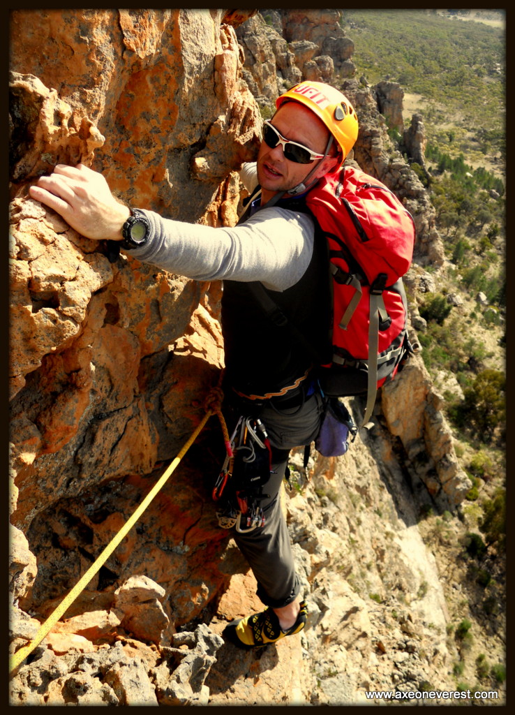
Climbing Arapiles – A vertical slice of Australian heaven

During early May 2014, I spent some glorious days rock climbing together with Alan Silva at Mt Arapiles in Western Victoria.  Mt Arapiles may be unfamiliar to non-climbing folk. However to rock climbers it is world-famous with over 3000 routes established on this amazing rock formation.  I will let the photographs speak for themselves to show the wonderful time we had sampling Mt Arapiles more well-known climbs.  We climbed a number of the ‘classic’ routes with names such as “The Bard, Muldoon, Syrinx, D-Major, The Trapeze, D-Minor & Piccolo”.  Mt Arapiles is around 3.5 hours drive from Melbourne and well worth a visit even if you are just going for a walk to enjoy the view.  All photo credits are to Alan Silva & Grant Rawlinson.

You can click on each photo to enlarge.

Favorite images from Peak to Peak 2013

Well as with all things in life – they come and they go.  At the end of the day all we have left are the memories.  Photo’s can be very nice to help preserve the nice times and I would like to share here our favourite images from Peak to Peak 2013. Thanks to Alan Silva and Tim Taylor also for contributing,

CLICK the above image to see an interactive map of our route on FOLLOWMYSPOT website!

CLICK the above image to see an interactive map of our route on FOLLOWMYSPOT website!


Robert Mills and Grant Rawlinson heading up the crater rim towards the summit of Tahurangi Peak, Mt Ruapehu

Robert Mills and Grant Rawlinson heading up the crater rim towards the summit of Tahurangi Peak, Mt Ruapehu. Photo Alan Silva

Grant Rawlinson, Jim Morrow and Robert Mills enjoy the view in the high winds from the summit of Tahurangi. Photo: Alan Silva

Grant Rawlinson, Jim Morrow and Robert Mills enjoy the view in the high winds from the summit of Tahurangi. Photo: Alan Silva

Grant Rawlinson, Jim Morrow and Robert Mills enjoy the view in the high winds from the summit of Tahurangi. Photo: Alan Silva

Grant Rawlinson, Jim Morrow and Robert Mills enjoy the view in the high winds from the summit of Tahurangi. Photo: Alan Silva

Alan Silva, Jim Morrow and Robert Mills descend the crater wall of Mt Ruapehu after reaching the summit.

Alan Silva, Jim Morrow and Robert Mills descend the crater wall of Mt Ruapehu after reaching the summit.

Alan Silva starting the cycle down the slopes of Mt Ruapehu towards Taumaranui.

Alan Silva starting the cycle down the slopes of Mt Ruapehu towards Taumaranui.

Grant Rawlinson starting the paddle in the 'Divorce Machine' inflatable kayak down the Whanganui River.

Grant Rawlinson starting the paddle in the ‘Divorce Machine’ inflatable kayak down the Whanganui River. Photo Alan Silva.

Kayakers on the banks of the Whanganui river.

Kayakers on the banks of the Whanganui river.

Campsite 'Poukaria' on the banks of the Whanganui river.

Campsite ‘Poukaria’ on the banks of the Whanganui river.

Canadian kayaks line the banks of the Whanganui river.

Canadian kayaks line the banks of the Whanganui river.

Grant Rawlinson paddles the final 20km stretch of the 245km  to Whanganui town.

Grant Rawlinson paddles the final 20km stretch of the 245km to Whanganui town.

Alan Silva and Grant Rawlinson enjoying the paddling in the rain.

Alan Silva and Grant Rawlinson enjoying the paddling in the rain.

Low could lines the banks of the Whanganui river as we paddle in the rain

Low cloud lines the banks of the Whanganui river as we paddle in the rain

Alan Silva and Grant Rawlinson in the middle of the Cook Strait.

Alan Silva and Grant Rawlinson in the middle of the Cook Strait. Photo Tim Taylor.

Tim Taylor approaching Arapawa Island after paddling the Cook Strait.

Tim Taylor approaching Arapawa Island after paddling the Cook Strait.

Grant Rawlinson takes a photo of the Tory Channel  entrance after paddling across the Cook Strait from Makara beach in Wellington.

Grant Rawlinson takes a photo of a ferry exiting the Tory Channel entrance after paddling across the Cook Strait from Makara beach in Wellington. Photo Tim Taylor.

A ferry enters the Tory channel as seen from Arapawa Island.

A ferry enters the Tory channel as seen from Arapawa Island.

Who is that in the paper?

Who is that in the paper?

Another day, another puncture on the ride south towards Mt Cook.

Another day, another puncture on the ride south towards Mt Cook. Photo Alan Silva.

Alan Silva getting wet during a rain storm on the cycle south.

Alan Silva getting wet during a rain storm on the cycle south.

Alan Silva enjoys a rest break on the cycle south.

Alan Silva enjoys a rest break on the cycle south.

Alan Silva cycles along the Kaikoura coastline.

Alan Silva cycles along the Kaikoura coastline.

Alan Silva cycles past Lake Tekapo.

Alan Silva cycles past Lake Tekapo.

Enjoying a rest break on the ride south.

Enjoying a rest break on the ride south.

Alan Silva climbs steep moraine above the Tasman Glacier on the way to Cinerama Col.

Alan Silva climbs steep moraine above the Tasman Glacier on the way to Cinerama Col.

Grant Rawlinson just visible on centre right about to cross under the Anzac peaks on avalanche and rock fall threatened slopes.

Grant Rawlinson just visible on centre right about to cross under the Anzac peaks on avalanche and rock fall threatened slopes. Photo Alan Silva.

Alan Silva climbs the summit ride on Aoraki/Mt Cook.

Alan Silva climbs the summit ride on Aoraki/Mt Cook.

Alan Silva climbs the summit rocks on Aoraki Mt Cook.

Alan Silva climbs the summit rocks on Aoraki Mt Cook.

Grant Rawlinson on the summit of Aoraki/Mt Cook.

Grant Rawlinson on the summit of Aoraki/Mt Cook. Photo Alan Silva.

Alan Silva enjoys his 7th time on the summit of Aoraki/Mt Cook.

Alan Silva enjoys his 7th time on the summit of Aoraki/Mt Cook.

Alan Silva descending the summit rocks on Aoraki/ Mt Cook.

Alan Silva descending the summit rocks on Aoraki/ Mt Cook.

Alan Silva descending through the crevasses on the Linda Glacier.

Alan Silva descending through the crevasses on the Linda Glacier.

The calm before the storm

Hello from windy Makara beach at the bottom of the North Island of New Zealand! We arrived here yesterday after 2 days and 215km of biking from Whanganui town.  The biking was fairly easy as we had a tail wind most of the way!  It rained like hell on the 1st day cycling, to a point where I got very cold.  This coupled with the trucks thundering past – 1m away from our handlebars down State Highway 1, made it a unique experience.  I had my first puncture after only 20km cycling and had a freezing wet and cold pit stop to change the inner tube on the side of the road.

Loving the rain and the vehicles!

Loving the rain and the vehicles!

Fixing the first flat tyre in the rain after  20km.

Fixing the first flat tyre in the rain after 20km.

Enjoying a beer in Levin at the end of 110km.

Enjoying a beer in Levin at the end of 110km.

Alan enjoying some nice weather outside Levin.

Alan enjoying some nice weather outside Levin.

Levin was a pleasant one night stop-off in the tent.  The most exciting thing that happened was that I ate the hottest Indian Bryani dish I have ever tasted.  I spent 30 minutes with ice held against my lips, then 30 minutes on the toilet before I could think straight.  The waiter and chef were laughing at me,  however I think I got the last laugh. As I left the restaurant he asked “was everything ok with your food?” to which I replied with a very straight face “no there was one problem…… it was not hot enough”.

The next day’s cycle from Levin to Makara near Wellington was also with a tail wind, and we blew along very quickly until we reached Porirua.  The traffic was getting extremely heavy by this stage but still there was a decent road shoulder to ride on.  We pulled off SH1 at Porirua and headed on smaller roads through the small town of Tawa and then up, up and over a HUGE hill followed by a nice roll down the other side to Makara.  We stayed at the Makara B&B, which is run by host’s Christine and Pat.  They cooked us a delicious BBQ dinner of fresh Paua, Steak and chicken, washed down with crisp NZ wine.  A wonderful evening. If you ever pass through Wellington and want to stay in a beautiful, quiet and peaceful setting, only 20 minutes from the city with lovely hospitality stay here!

The next stage of our trip is one of the hardest and most dangerous.  Sea kayaking across the Cook Strait.  The Cook Strait is a notoriously rough, windy and fickle stretch of water with huge tidal streams (i.e currents).  It is a serious stretch of water for motor vessels, let alone tiny kayaks.  We always knew we needed a weather window of low wind speeds, a clear day and low swells to even contemplate this crossing.  The weather changes so fast in the strait that even the weather forecasts are fickle and often proved wrong.

We are working with Tim Taylor from NZ Kayaking for this section.  Tim has driven down from Tauranga and supplied the kayaks and will paddle across with us. He is very experienced and we feel in very capable hands with his support.

The weather window we are waiting for seems to be tomorrow (Tuesday) morning – around 4AM – 12PM.  We need 6 – 8 hours to get across safely. The wind speeds pick up tomorrow lunch time.  So we MUST be over and in the safety of the sounds before lunchtime.  The other issue is what route do we take into the sounds?  Plan A was to head north of Arapawa Island and head into Ship Cove for the night.  Plan B is to head into Tory channel, where the ferries go, which has some horrific currents for kayaks to negotiate (7 – 8 knots).  However with an incoming tide and the northerly winds pushing us in that direction it could be an option.  You can follow our real-time SPOT GPS tracker to see our route:  http://axeoneverest.followmyspot.com/peak-to-peak-2013

We will be carrying EPIRB emergency beacons, Marine VHF radio’s, Satellite Phone’s and the SPOT messenger tracking our progress every ten minutes.  We will not have a support boat with us.  So the plan is to punch hard as possible across the strait, starting at 4:30AM and try and get into the sounds before lunch.  Wish us luck!

Today we also did a small presentation to the local Makara primary school, got interviewed and photographed by the DOMINION newspaper (thanks Paul!), tested the double kayak out, and will hand our bikes over this evening to my cousin Liz and her partner.  They have very kindly offered to pop them on the BLUEBRIDGE ferry tomorrow to send them to Picton – thank you Bluebridge for your support! And thank you Liz and partner for your awesome support also!

Tim Taylor from NZ Kayaker and Alan Silva at Makara beach this morning - scoping the route out across the Cook Strait.  27km to safety on the other side!

Tim Taylor from NZ Kayaker and Alan Silva at Makara beach this morning – scoping the route out across the Cook Strait. 27km to safety on the other side!

A trial paddle off Makara beach this afternoon.

A trial paddle off Makara beach this afternoon.

That’s all for now – the next time we report in, we will either have crossed the Cook Strait…..or not!

Axe


Peak to Peak 2013 – Meet the team!

‘Peak to Peak 2013’ is not about doing an expedition with a huge budget and a lot of support.  In-fact we have made a conscious effort to do away with support vehicles and vessels and instead focus on selecting a small team of super-experienced people to get the job done.  It’s an interesting exercise in team management  – choosing the right people for the right job.  I am pleased to introduce the team below:

Jim Morrow

jim morrowI had the pleasure of getting to know Jim Morrow during an expedition to the North Ridge of Everest in 2011.  The first thing that I remember noticing about Jim was how fit he appeared.  After meeting him and getting to know him, I quickly realised Jim was a great companion.  Tough, dependable, super-experienced and down to earth.  We spent much of the expedition walking or climbing between camps together.  Jim is aged 63 and started outdoor adventure at age 13 with his school tramping club.  Since that time he has amassed an incredible amount of experience in the ranges and mountains around New Zealand and Nepal.  And it isn’t over yet! Jim joined the Auckland Tramping Club after leaving school and covered much of the NZ back country with the club.  His love for tramping, climbing and ski-ing has seen him climb all North Island mountains more times than he can remember.  He is a member of the unofficial “Three in a Day Club”(membership requires climbing Ruapehu, Ngauruhoe Tongariro, and returning to base within 24 hours).   Jim summited Mt Cook in 2002 and moved on to five Himalaya expeditions. In 2005 he successfully summited Lhakpa Ri, 7045m, sled hauling from the Rongbuk Glacier to the Kangshung.   In 2007 Jim attempted Cho Oyu ( 8200m), but was turned back by a storm.  In 2009 he made the first known ascent of the north side of Himlung, 7126m. In doing so he became the first kiwi to summit Himlung by any route. In 2011 Jim attempted Mt Everest and turned back at 8550m in very strong winds.  Jim was the 2012 leader of the Auckland Tramping Club team to Saribung Peak, 6328m and Mustang Kingdom trekking.

Jim is a key team member of Peak to Peak 2013, being the transport support to get us from Auckland International Airport to Mt Ruapehu and he will also be joining us on our climb to Tahurangi – the summit of Ruapehu – something Jim likes to do at least once every year.

Alan Silva

Alan at Unwin Hut Feb 2011 Photo Grant Rawlinson Collection-001‘Quiet achiever’ would be the best term to describe Alan Silva.  I first met Alan while rock climbing.  Alan was rope soloing (climbing by himself, using a rope for safety which he controlled himself – not a particularly straight forward thing to do).   It was very impressive to see the ease and confidence he scampered up vertical rock, belaying and rope handling  himself.

In his own words Alan is a wrinkled old fart who enjoys nothing better than dragging his battered old & wrinkled carcass on another of life’s wondrous journeys. He is constantly amazed by the great adventure to had by simply by putting one foot in front of the other particularly when all have decided that maybe stamp collecting poses a lesser risk. While ever there is still a glint in his eye and a taste of adventure to be had, be it a little vertical foolishness on the pointy end of a rope, a mountain-bike dash down an expanse of black tarmac/bush track or a paddle between distant islands he’ll be hard at it.

Australian born Alan, 52 has bushwalked, climbed, caved, canyoned, kayaked, cycled since humping a backpack at 8 years old and shows no sign of letting go… with two Everest summits (in one week), a solo climb of the North Face of the Eiger and 9 of the Seven Summits under his feet – all going well; the Peak to Peak trip will be his 7th time to view Aotearoa (New Zealand) from the top of Aoraki/Mt Cook .

Alan is a professional structural engineer by training and a dad to two daughters, Rana and Tashi.  When not adventuring Alan currently resides in Como, Sydney – Australia.

For such an accomplished mountaineer and climber, Alan prefers to fly under the radar and you will struggle to find his name in magazines/websites or media.  One of the few books he does make an appearance was written by the well known ‘TV adventurer’ – Bear Grylls, who much to Alan’s disgust spells his name wrong.     “I keep reading about this mythical Aussie climber by the same of ‘Allen’ Silva written in a few books by the adventurer & TV personality Bear Grylls.. Fuck, am I happy not to be that fella – but then again if I was I would have done the world a favour and pushed Bear off the summit of the Big E to shut him up…!”

Alan will be taking part in the full length of the ‘Peak to Peak 2013’ and his extensive expedition experience, especially on Mt Cook will be invaluable.

Tim Taylor

OLYMPUS DIGITAL CAMERATim Taylor will be joining ‘Peak to Peak 2013’ for the kayak leg across the Cook Strait.  Tim will be supplying the kayaks and also joining us on the paddle.  Tim began kayaking at the age of 12 while in his first year of high school. He was very fortunate to become involved in the sport through the strong whitewater slalom team at his school and quickly grew into a good paddler under the guidance of coaches and senior paddlers. Within a few years Tim was selected for the New Zealand Slalom team and was competing at a national and international level. Tim also participated heavily in extreme whitewater in a sport that we now call ‘creaking’ (it didn’t have a name back then).
After high school Tim stopped paddling for a few years and concentrated on study at Lincoln university, ultimately qualifying with a Bachelor of Viticulture and Oenology (winemaking). After graduating he worked, traveled, and got back into kayaking seriously when he moved back to Tauranga. After a stint in Europe, Tim came home with the idea of circumnavigating New Zealand in a Sea Kayak. This was a distance of roughly 5500km and had never been undertaken in one continuous journey. A few people had paddled around the individual islands but no one had ever attempted in one go and many said it was impossible.
In Christmas 2013 Tim left his job and committed himself to a year of full-time training and preparation for the New Zealand expedition. Paddling an average distance of 40km per day, he gained an immense level of fitness and skill. This served him well when he began his trip on November 29, 2010. During this trip Tim paddled up to 80km a day, following the coastline and camping on the beach at night. The summer of 2010/2011 was extremely bad for weather and Tim spent long periods of time stuck in remote locations. He ultimately had to finish his trip on May 2011 at 90 mile beach, as he was unable to round Cape Reina in the rougher winter conditions. Tim returned in February 2012 and finished the final leg back to Tauranga in just under 1 month.
With the experience that Tim gained from the New Zealand trip and also his whitewater background, Tim is in a position where he is considered as one of New Zealand’s top kayakers.   He has grown to love the freedom of the kayaking lifestyle so traded jobs and became a full-time kayaking guide. Eventually he started his own kayaking company (click here) that specialises in remote kayaking and fishing trip.  He will release his first book later this year on Kayak fishing.

Robert Mills

rob mills hunting march 2010 006

Robert Mills is happily married to Denise and the father of 2 young boys, Liam and Matthew.  Robert resides in Stratford, Taranaki, New Zealand.  Robert grew up on a sheep farm in the remote eastern Taranaki hill country and moved away to boarding school at age 12 then onto University where he graduated with a degree in Law and Accounting.  Robert has long enjoyed the outdoors, unfortunately not always in my company.  In 1996, Robert and I walked the Routeburn and Greenstone tracks in the South Island of New Zealand.  It was  a walk where we encountered torrential rain and carried much to heavy packs.  I had been in charge of the food, and had assigned Robert one fully cooked roast chicken to carry for dinner on the second night.  All of our feet became very sore and compounded with the heavy packs resulted in Robert informing me in no uncertain terms this would be the last trip he ever made with me.

Fortunately time has a way of dulling the memory of pain, and Robert has agreed to join ‘Peak to Peak 2013’ for the start of the journey on the climb to Tahurangi (the summit of Ruapehu), this time without the roast chicken. Robert has been training hard on the slopes of Mt Taranaki and also hunting trips in the build-up to December’s climb.  Robert is also a volunteer fireman with the Stratford Volunteer Fire Brigade.  He drove the fire engine to the scene of my sister Debra Avery’s horrific car accident in 2012(read more here).  Along with the rest of the emergency crews which responded and helped to save Debra’s life, Peak to Peak 2013 plan to present Robert a NZ$1000 donation on the summit of Mt Ruapehu – to be shared between the volunteer emergency services which attended the accident.

Jack Rawlinson

IMG_1156-001

Jack Rawlinson is a 71-year-old hill country sheep and beef farmer from Eastern Taranaki.  Jack was born in Taranaki and has worked and lived on the family farm that has passed down through the generations, with Jack being the 3rd generation Rawlinson to run the property.  A ‘man of the land’ literally, Jack left school at 16 and has been on the farm ever since, his favorite place in the world.

Jack has recently acquired two brand new knees (i.e full knee re-constructions) and was very eager to try these out by joining Peak to Peak 2013 for the climb of Ruapehu.  However he has also been slightly under the weather and will be undergoing surgery on his hand next week, so it appears he may be joining as the expedition cook for the first evening of the expedition only.  Jack also happens to be my father so I have tasted his cooking many times.  I can confirm it is very nice so we are all happy with this arrangement.  Jack will also take our bikes from Taumaranui and deposit them at Whanganui town at the bottom of the Whanganui river at the end of our 240km paddle.

Greg Moore

IMG_2898

Greg Moore, is a long-time friend and supporter of my adventures and grew up in South Canterbury, New Zealand.  After working in New Zealand for many years he has spent the last major period of his life working in remote locations in Indonesia as a construction manager.  Greg spent many years exploring and climbing around the Southern Alps in New Zealand in his younger days with a core team of buddies.   Greg is married to Yoke, with three daughters and a young granddaughter. Greg hung up his climbing gear a few years back but now enjoys other passions in his life, including geocaching.  He is also a fulltime All Black supporter and loves travelling to exotic destinations with Yoke during their time off and even the occasional beer.

Greg is familiar with the route the Peak to Peak 2013 expedition will be taking, especially in the South Island section, so has kindly volunteered to update the expedition blog while we are en-route.  Greg will post updates as I call them into him by Satellite phone.  Much of the area we will be travelling through will have no mobile phone access.

Grant Rawlinson

IMGP0291

Finally there is me. Grant ‘Axe’ Rawlinson, 39 years old, born and bred in Taranaki, New Zealand, and now living in Singapore where I work as an inspiring keynote speaker and a regional sales manager.    I have long enjoyed taking part in unique expeditions to remote corners of this beautiful earth and have climbed in amazing locations such as Patagonia, the Andes, Kyrgyzstan, Kazakstan, Pakistan, Nepal, Russia, Africa, Tibet and Iran.  One of my favorite places to climb and adventure is still New Zealand and over the years I am firmly in the belief that if you can climb and look after yourself in the rugged and tough conditions in New Zealand – then you can look after yourself anywhere.

‘Peak to Peak 2013’ is my brain child and is really an excuse to have an adventure with some good mates, whilst trying a completely human-powered adventure. I  am extremely interested in human-powered adventure and just how far we can take this concept.

The major objective of any of my adventures is to come home safely, so responsible risk-taking and wise decision-making will be at the forefront of our approach.  We hope you will enjoy following our progress!

EXMAG article on climbing Mt Dixon

Hi folks,

Stephanie and I have just returned from a glorious trip driving the ‘Big Sur’ from San Francisco to Los Angeles.  I will post some pictures shortly from the trip.  What a beautiful part of the world.

Some very exciting news from the trip is that I managed to purchase a nice new shiny yellow hand-pump, to pump water from the Divorce Machine when she fills up with water on our next microadventure. For some reason Stephanie does not seem half as excited as I am about the purchase. She appears to like the three pair of shoes she bought much more than the pump.  Woman can be very strange sometimes.

In the meantime check out the link below(click on the photo) to see a write-up of Alan Silva and my recent climb of Mt Dixon, New Zealand in January 2013.  Turn to page 66.

Or click on the link here to bring you there:  http://exmag.sg/online-magazine/2013/april-may/index.html#/66/


EXMAG article  on Alan Silva and my climb of Mt Dixon in New Zealand in January 2013. Click on the image and turn to page 66 to read it online.

EXMAG article on Alan Silva and my climb of Mt Dixon in New Zealand in January 2013. Click on the image and turn to page 66 to read it online.

Till next time!

Axe


The Mt Dixon landslide – mother nature in action

On Friday 4 January 2013, together with Alan Silva, we climbed Mt Dixon, New Zealand’s 23rd highest peak. (Read about that climb here.)

The summit ridge of Mt Dixon is an exposed knife-edge and I wrote at the time:

“I tried not to look down either side at the hundreds of meters of free fall that maybe a base jumper would appreciate however served to intensify my focus on not slipping as we had no protection in.”

The below photo shows Alan Silva climbing the last few steps to the summit of Mt Dixon.

Alan Silva works his way up the final summit ridge on Mt Dixon

Alan Silva nearing the summit of Mt Dixon, 4 January 2013. The rocky, snow-covered ridge line to his left, just past the summit, appears to have dropped off in the huge land slide on 21 January 2013.

What is important to note in this photo is the rocky/snow-covered ridge line to the top left of Alan’s shoulder. In spectacular fashion, 3 days ago on the 21st January, an enormous chunk of this summit ridge of Mt Dixon fell off. It fell around 500m vertical metres to reach the glacier below, creating a massive landslide which spilled out an incredible 3 horizontal kilometers onto the grand plateau. It narrowly missed Plateau Hut by only 200m (where we spent two nights before and after the Mt Dixon climb).

No one was injured in the landslide, however it must have been a magnificent spectacle to witness at the time. Eye witnesses liken the noise created to “a 747 jet on take-off”. The image below shows the extent of the landslide. The image is courtesy of Alpine Guides. I have added the positions of the summit of Mt Dixon, Plateau Hut, Syme Ridge on Mt Tasman, the Grand Plateau and our route up Mt Dixon. You can see from our route that we chose a very sensible line, well out of harms way!

Image taken by helicopter by Alpine guides. The red line shows our ascent route up Mt Dixon.  Clearly evident is the ridge line on Mt Dixon where the landslide started. Plateau hut is circled in red.  To give a sense of scale, the horizontal distance from the bottom of the ridge to where the landslide ended is 3km.

Image taken by helicopter by Alpine guides. The red line shows our ascent route up Mt Dixon. Clearly evident is the ridge line on Mt Dixon where the landslide started. Plateau hut is circled in red. To give a sense of scale, the horizontal distance from the bottom of the ridge to where the landslide ended is 3km.

The below video footage also courtesy of Alpine Guides shows the extent of the volume of rock and debris, and just how close it came to Plateau Hut.

I also attach some links to interesting articles which describe more about the landslide.

Seeing natural events occurring like this is so very humbling. The power of mother nature to unleash thousands of tons of rock from a huge mountain ridge hundreds of meters in the air in an instant and send it crashing down to the valley floor below for kilometers. All I can say is… WOW!!

http://blogs.agu.org/landslideblog/2013/01/23/an-analysis-based-on-images-and-video-of-the-mount-cook-national-park-landslide-on-monday/

http://www.ouramazingplanet.com/4032-new-zealand-rockfall-pictures.html

http://www.3news.co.nz/Large-landslide-on-Mount-Cook-PHOTOS/tabid/1160/articleID/283869/Default.aspx

Malte Brun – The return

There is only 40 days left until I leave for Everest.

On Tuesday I will leave Singapore for a training climb on a peak called Malte Brun.  Malte Brun  is a large mountain located in the Southern Alps of New Zealand, right opposite Mt Cook (New Zealand’s highest peak).  Standing at 3198m, Malte Brun is the 6th highest mountain in New Zealand (depending on the specification you use to define what exactly is a peak).

In February 2010 I  attempted Malte Brun, together with Alan Silva.  We had an epic 8 day adventure where we climbed high on the Full West Ridge route – a route very infrequently attempted due to its length and committing nature.  We eventually turned around at 2950m, around 250m below the summit.  It was a grueling climb – 17 hours for the summit push alone, continuously on the move with only 1 litre of water to drink.  After three nights in De La Beche hut, two nights in the tent, and two nights bivvying (sleeping in the open) high on the ridge, a cut rope, a marathon 2 day descent, we finally stumbled back out to the road head.  By this time we were two day’s over schedule, I had missed my flights, and more importantly put a great deal of stress on my family who had been waiting for me, since my non-arrival at the airport two days before.  They had naturally been concerned and called the Police.  So we were not too far from having a SAR operation come looking for us which would not have been cool.  You can read the full trip report here.

Alan Silva about to abseil steep rock on the West ridge of Malte Brun

Together with Alan, we will return to Malte Brun next Wednesday to make another attempt on this mountain.  Weather permitting, we will attempt a slightly shorter route known as the ‘West Ridge’ (as opposed to the ‘Full West Ridge’) as shown in the photo below.  I took this photo in 2009, from the summit of a neighboring 3000+m peak called The Minarets.

View of Malte Brun from the summit of the Minarets. The West ridge is the prominent ridge on the right hand side leading up to the summit.

As with my return to Everest this year, I take what I learnt from my last attempt on Malte Brun and make the necessary adjustments to my gear and tactics etc.    This process is one of the great thing’s that I enjoy about independent non-guided climbing.  The research, planning, preparation and training which lead up to attempting a particular route.  The actual climb itself.  Sometime I make it, sometimes I don’t.  If I don’ t make it, I lick my wounds, then get stuck back into applying the experience that I have learnt from the previous climb, to prepare even better for the next attempt.  This is also a magnificent way to learn.

Some of changes we will make for next weeks attempt on Malte Brun include:

1.  Taking a Satellite phone for communications

2.  Travelling with lighter gear

3.  Using a 6mm, 50m cord for the descent abseils.

4.  Attempting a shorter variation of last year’s route

It will make a welcome change to be back on a mountain after the last few weeks humping heavy packs up and down the stairs in Bukit Timah nature reserve.  Have a great week ahead and I will look forward to updating you on whether or not Malte Brun is done!

Stair training in Bukit Timah Nature Reserve, Singapore


%d bloggers like this: