Blog Archives
Peak to Peak 2015 – Slaying the Dragons Horns, Tioman Island, Malaysia
In 8 days time, Peak to Peak 2015 will set-off….
In 2013 Alan Silva and myself made our first Peak to Peak Odyssey from the summit of Mt Ruapehu in New Zealand to the summit of Aoraki Mt Cook, completely by human power (read more here). In 2014 we made our second Peak to Peak journey this time on the opposite side of the world, from the summit of the UK (Ben Nevis) to the summit of France – Mt Blanc, (read more here).
Our Peak to Peak journeys follow these basic principles:
- Begin and End on interesting mountain summits
- The journey between the summits made completely by human power
- The expedition to be completed on a shoe string budget
- The expedition to be fit into our annual leave entitlement
- Our particular journey/route has never been attempted before
- The ‘style’ of the expedition to be carried out with as little support as practically possible.
Peak to Peak 2015 will adhere to the same philosophy as the previous expeditions and involve us starting on the summit of Singapore – the mighty Bukit Timah Hill at 163m above sea-level. From here we will make our way by bicycle 150km north, into Malaysia to the small town of Mersing on the east coast of Peninsula Malaysia. From Mersing we will make a 65km open water sea-kayak directly offshore to reach the Island of Tioman. Tioman is a small but beautiful, heavily forested Island, surrounded by Coral Reefs. According to legend (and Wikipedia!): “Tioman Island is the resting place of a beautiful dragon princess. Whilst flying to visit her prince in Singapore, this beautiful maiden stopped to seek solace in the crystal-clear waters of the South China Sea. Enraptured by the charms of the place, she decided to discontinue her journey. By taking the form of an island, she pledged to offer shelter and comfort to passing travelers.”
The geology and geography of Tioman island is very interesting. Massive granite outcrops reach out from the steep jungle, rising vertically hundreds of metre into the heavens. The most impressive of these are twin 400m vertical monoliths known as the “Dragons Horns”
We will be attempting to finish our expedition with a big-wall-style, three day, vertical ascent of the Dragons Horns, which have only been climbed a handful of times since the very first ascent in the year 2000.
As usual we be using a SPOT Tracker to track our progress in real-time, I will share the link within the next few days before we depart. We expect this mini-expedition to take us 7 days in total – wish us luck!

The Dragons Horns on Tioman (Photo source: http://www.headlampsclusterfucksandotherverticaladventures.com/)
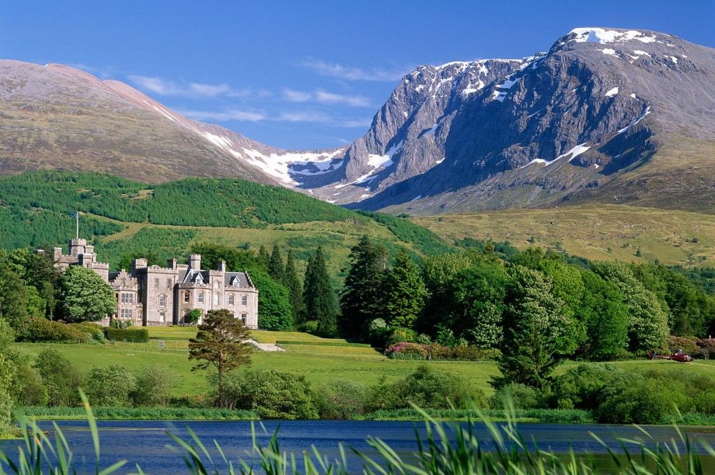
Peak to Peak 2014 – Summit of the UK to the summit of France by our own human power!
I enjoyed Peak to Peak 2013 so much (the first ever human-powered traverse from the summit of Mt Ruapehu to the summit of Mt Cook in New Zealand) that it inspired me to do two things:
1) Write a book about the trip – this is currently undergoing the last round of editing and will be published shortly.
2) Repeat the expedition, with a slight twist. This time, it won’t be in New Zealand, and it won’t be between two islands in the same country, but between the UK and France.
Peak to Peak 2014 will involve Alan Silva and I making the following journey:
– Climbing the finest alpine route in all of Scotland & the UK – the tower ridge of Ben Nevis (1,344 m elevation)
– Over 2000 km of road cycling through four countries (Scotland, England, France and Switzerland).
– a 30+km sea-kayak crossing of the English Channel
– Ending with a complete traverse of Mt Blanc – the tallest mountain in France and Western Europe (4,810 m elevation)

Ben Nevis, the highest point in the UK at 1344m above sea-level and our official starting point for Peak to Peak 2014 (Photo source: http://www.thestylebox.com/2014/05/29/closer-to-home/)
As with Peak to Peak 2013, we will be travelling with as little support as practically possible and on a shoe string budget, fitting the entire expedition into our annual leave constraints.
We will be starting our expedition on the 16 August and hopefully ending on September 10.
You can follow our progress in realtime from the comfort of your home on the GPS SPOT TRACKER. And if anyone would like to join us for an hour or two’s cycling along the way then we would love your company – you can easily track us down by following our position on the GPS SPOT TRACKER.
The map below shows our approximate route, and if anyone lives on the route or close to it, then please do shout out as we are very happy to have a place to stop by for cuppa or even a bed for the night if your hospitality permits.
Our expedition starts officially in the 15 August and will hopefully end by September 10.
We will be posting daily updates and also short video blogs so we hope you will enjoy following along.
I would like to thank UFIT for supporting physical conditioning and SWORKE for supporting the expedition eyewear.
Off belay!
Axe
Peak to Peak – A Great Start!
Hello everyone, we have some updates for you on the teams progress. They have already covered a lot of ground since meeting together in Auckland; Day 1 being the successful ascent of Mount Ruapehu – (Tahurangi). At 2797m , this New Zealand’s North Islands highest mountain and one of the world’s most active volcanos and it is the largest active volcano in New Zealand. The latest information from `The Axe’ follows:
`Basically, the climb of Ruapehu yesterday was much tougher than we thought. It was a clear day but very windy up top, with estimated wind chill -5 to – 10. The summit ridge requires an exposed traverse to gain, and this was hard ice. Rob Mills was wearing crampons and axe for the first time and did extremely well to get past this section. We roped up here for safety, Alan also had some problems with his instep crampons which here not suited to hard icy traverses. So it was a slow last 50m to gain the summit as he and Jim were forced to cut steps all the way, resorting to old style climbing! We reached the summit at 1pm exactly, I sent a spot messenger OK message to prove we hit the summit. On the summit it was so cold my camera froze however I managed two quick photos with Alan and with Rob Mills and the NZ Fire Service flag. We donated 1000 dollars on the summit to the Toko and Stratford Fire Departments. Both who were involved in Debra’s rescue last year.
Mount Ruapehu, Crater Lake behind. Very Windy and cold.
We reached the comfort of the hut 10.5 hours later at 1730hrs. We are all a little tired, sunburnt with sore feet. Jack Rawlinson had cooked a very nice meal of corned beef, potatoes, brocolli and carrots. We were all in bed by 9pm.
After a great breakfast, today we will cycle 60km to Taumaranui, stock up with 5 days food, then begin our paddle this afternoon down the Whanganui river. This has very steep gorges, so I am unsure if the spot tracker will work.
Thanks to Rob Mills, Jack Rawlinson, Jim Morrow and Ngaire Rawlinson for the support for the Ruapehu segment. Thanks also to the Wonderful hospitality in the Auckland Tramping Club lodge at Whakapa where we spent the last two nights.’
Bacon, eggs and sausages for breakfast this morning on Day 2 of Peak To Peak. Courtesy of Jim the legend Morrow.
We can see the guys are making excellent progress and are already well down river on Day 2. The weather is looking good for a few more days yet with a large high over the whole country, protected by a few stationary fronts. Its is hoped only smooth sailing is encountered by the divorce machine with reasonable flow only!!
To locate their exact position please click on the links:
Message: Axe reporting all ok from ‘Peak to Peak 2013’.See our position at: http://bit.ly/1bbBiVb
Click the link below to see where I am located.
http://fms.ws/Eo1qy/38.99158S/175.12001E
If the above link does not work, try this link: