An open water sea kayaking expedition to Pulau Pisang
To celebrate Chinese New Year (year of the horse), we saddled up our sea kayaks and took to the sea for an exploratory mission to Pulau Pisang Island (literally translating to ‘Banana Island’ in Malay). Pulau Pisang is located 14km off the coast of Malaysia in the Malacca Straits. The island officially belongs to Malaysia. However in 1900, Singapore signed an agreement with the Sultan of Johor which allowed them to operate a lighthouse from the Island in perpetuity. This has recently caused some political tensions between the two countries, mainly over sovereignty issues. We did not care too much about international politics as I believe the Island was there long before men were running around laying claim to certain pieces of the earth.
I had managed to convince Stephanie my wife and long-time rugby mate Andrew Glass (a.k.a ‘Glassy’) to join me. We set-off at 5:15AM from Singapore with two kayaks loaded up ( a double for Stephanie and myself and a single for Glassy). After an obligatory ‘athletes breakfast’ of roti prata (aka rote canai) in Gelang Patah in Malayia, we were in the water by just before 8am at the small town of Pontian and paddling.
It is a 14km open water paddle to reach the island. At this time of the year the prevailing winds are north-easterly due to the monsoon. Our paddle out to the Island took 2 hours and 30 minutes. Wind induced short period choppy swells sweeping in from behind made an uncomfortable journey as we were pushed and rolled around without warning. Stephanie and Glassy were amazed when I told them after 1.5 hours of paddling that the Island was still 7km away as it looked deceptively close.
We landed on the Island and had the company of some friendly Malay families who had come over in a boat and were swimming and enjoying themselves. We took a short walk to the lighthouse at the top of the Island which is permanently staffed and operated by Singaporean’s. They were very friendly to talk to and told us they work on a ten day on/ten day off shift. It would be a beautiful part of the world to have your office.
We enjoyed a tranquil lunch sitting on the small jetty on the Island before gearing up for the paddle back to the mainland. My water proof camera and waterproof GPS both gave up life on the journey meaning we steered mainly on a compass heading back the first half of the journey. The mainland looks so featureless from 14km away that it is hard to recognise features for navigation purposes. As we got closer Glassy recognised one of the landmarks to head for onshore. It was a good lesson not to completely rely on GPS or electronic navigation devices.
We arrived back after 2 hours and 15 minutes of paddling. Paddling across open water is a very different experience to coastal paddling (paddling alongside and parallel to the coastline). The scenery changes much slower in open water paddling. The conditions can get much worse and the commitment level is higher due to the fact if something goes wrong offshore then you can’t easily get into the safety of dry land. It can be an intimidating yet exhilarating feeling when you are so far from land with the weather conditions worsening. Stephanie’s arms were very tired and I was exceptionally proud of her for having the physical and mental strength to paddle for 5 hours, on her first open water crossing.
For anyone contemplating this paddle in the future, my advice to be wary that is longer than it looks to the Island! If anything goes wrong out there you are pretty much on your own. Cellphones do work from Pula Pisang so if you had a phone in a waterproof bag this would be a good back-up (and of course you must know who to call!). Navigation is also a challenge, especially if the visibility is poor. So prepare and train properly so that you have enough strength to paddle in choppy/windy condition’s for at least 5 – 6 hours, and enough experience to know what to do in the event that conditions change or something went wrong.
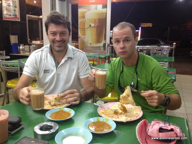
Could there be any better breakfast than this? Breakfast of champions – Roti Prata, fish curry and Teh Tarik!

Sunrise from Pontian town on the west coast of Malaysia, our launching point. (Photo” Andrew Glass)
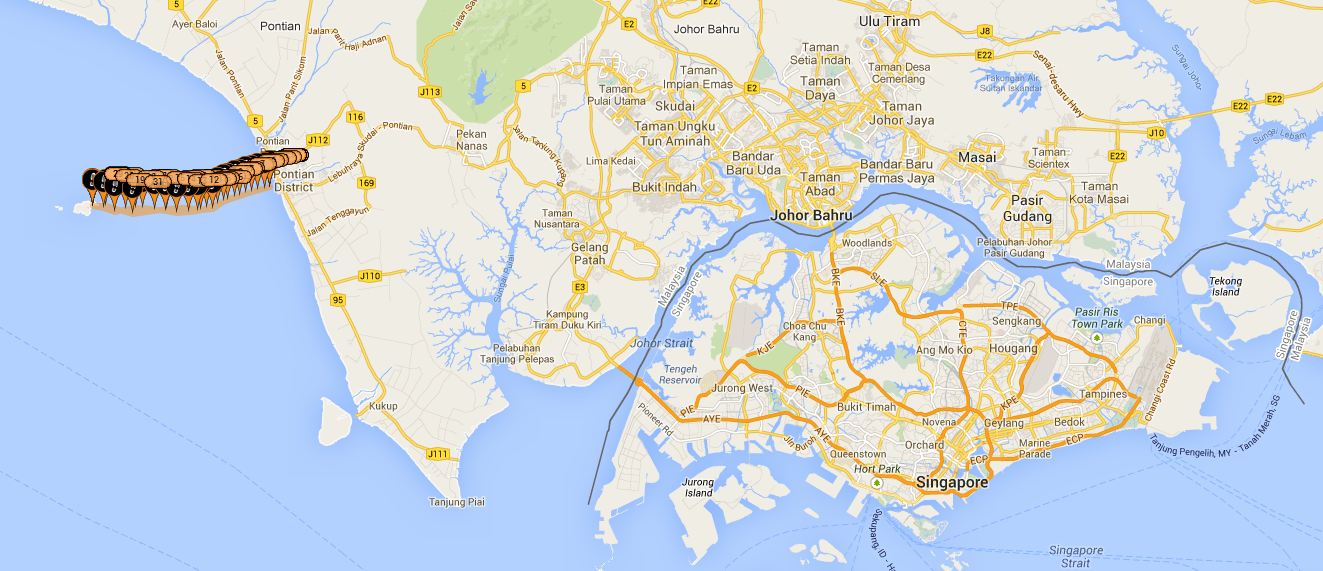
Our GPS track of our route to Pulau Pisang in relation to Singapore.

A close up of our GPS track to Pulau Pisang starting from the small town of Pontian. CLICK THE IMAGE TO SEE AN INTERACTIVE MAP DISPLAY OF OUR ROUTE!

7AM arrival at Pontian, we found a new breakwater under construction which we managed to drive out and launch off. From here Pulau Pisang is just visible 14km in the distance to the right of the vehicle.

Stephanie gets her feet wet at the bottom of the breakwater as we prepare to depart Pontian.
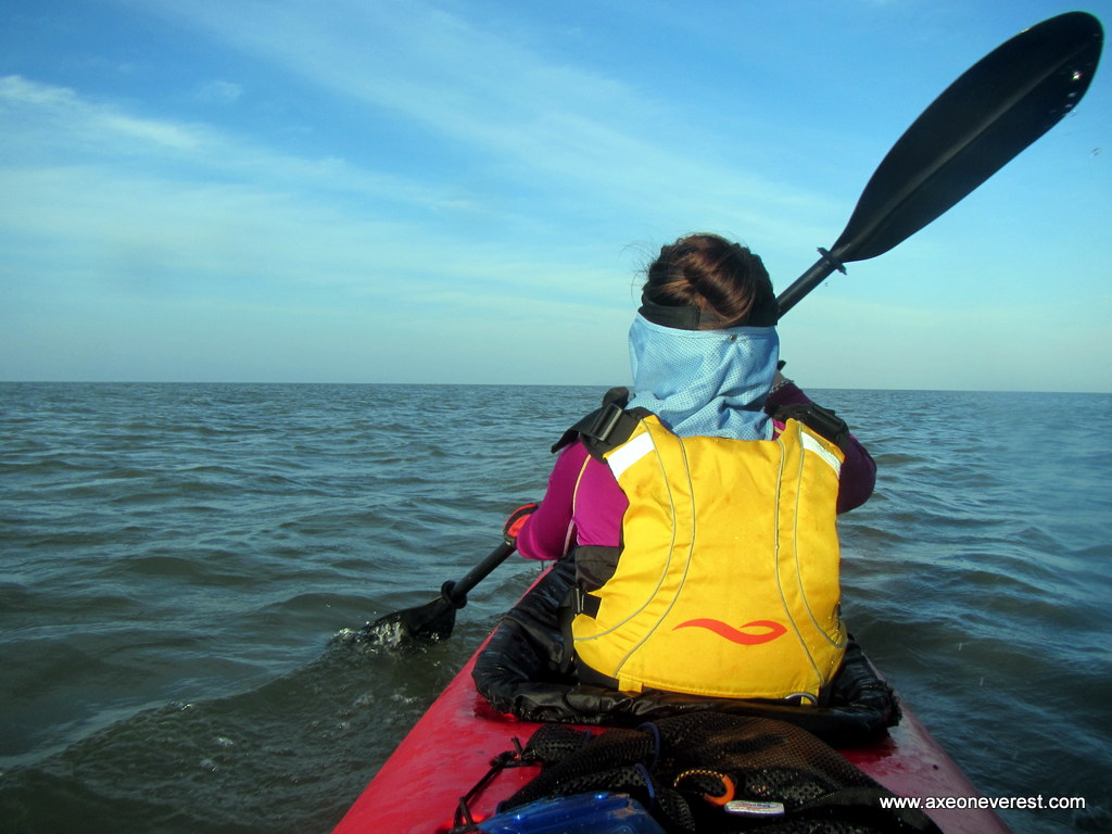
Under way. Pulau Pisang still looks a long long way away. Stephanie’s first open water kayaking trip and she was amazed how long it took to get to the Island.
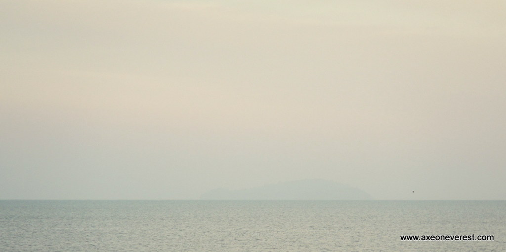
Pulau Pisang on a zoomed up shot from Pontian. Appearing as a ghostly haze on the horizon – about 13.5km as the crow flies.

Halfway through the paddle – about 7km from Pulau Pisang, the lighthouse starts to become evident as a white spec on top of the island.
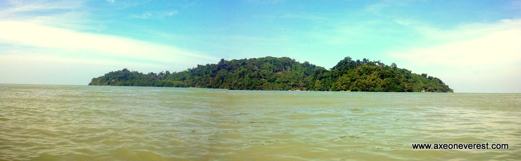
After 2.5 hours we had almost reached the island and could see a small bay with a jetty which we headed for in centre right of photo. This view is the east side of the Island. I had originally planned to kayak around the island however the wind and thought of the long slog to get back to the mainland meant I scrapped this idea. Maybe another time.

Stephanie and Glassy make friends with the local kampong kids on the island.
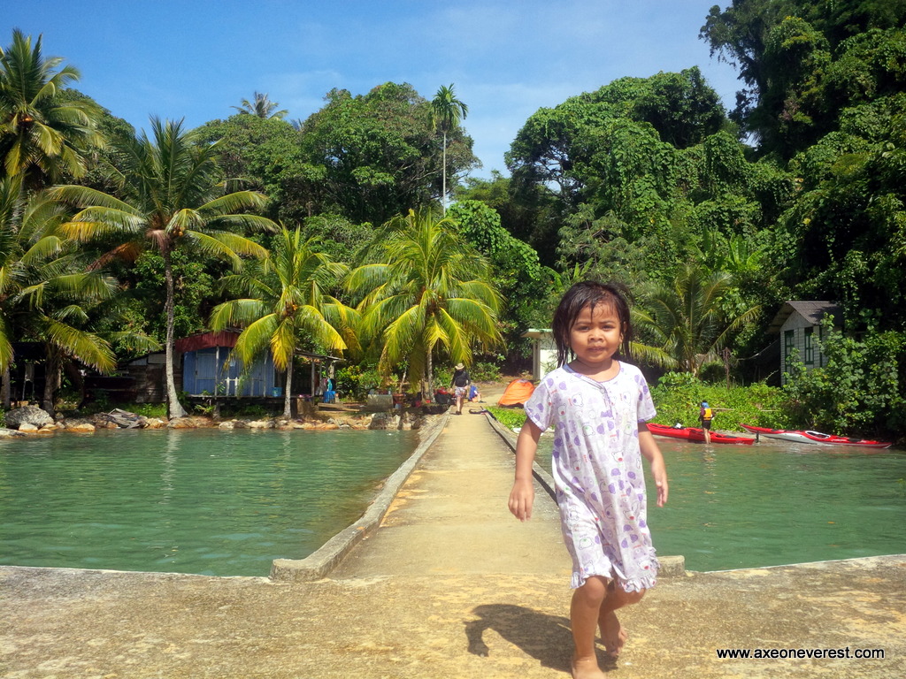
The jetty on the Pulau Pisang. There is one Malay family which lives here.
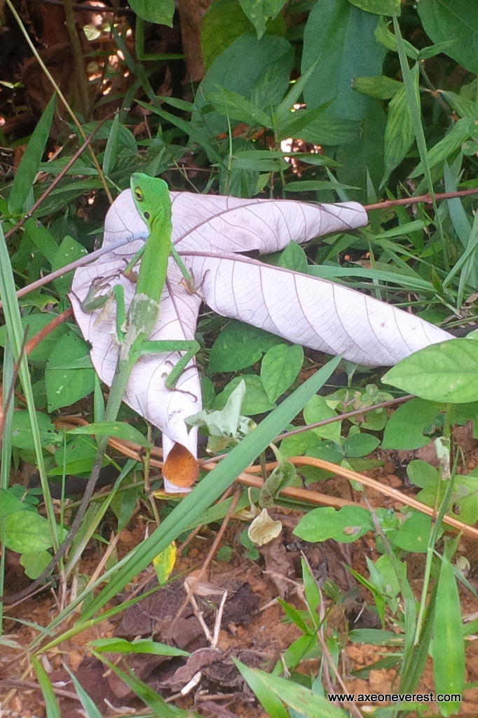
The island is full of lovely little lizards such as this green one here.

We wandered up the hill to the lighthouse. Access is denied so we took a photo from outside.
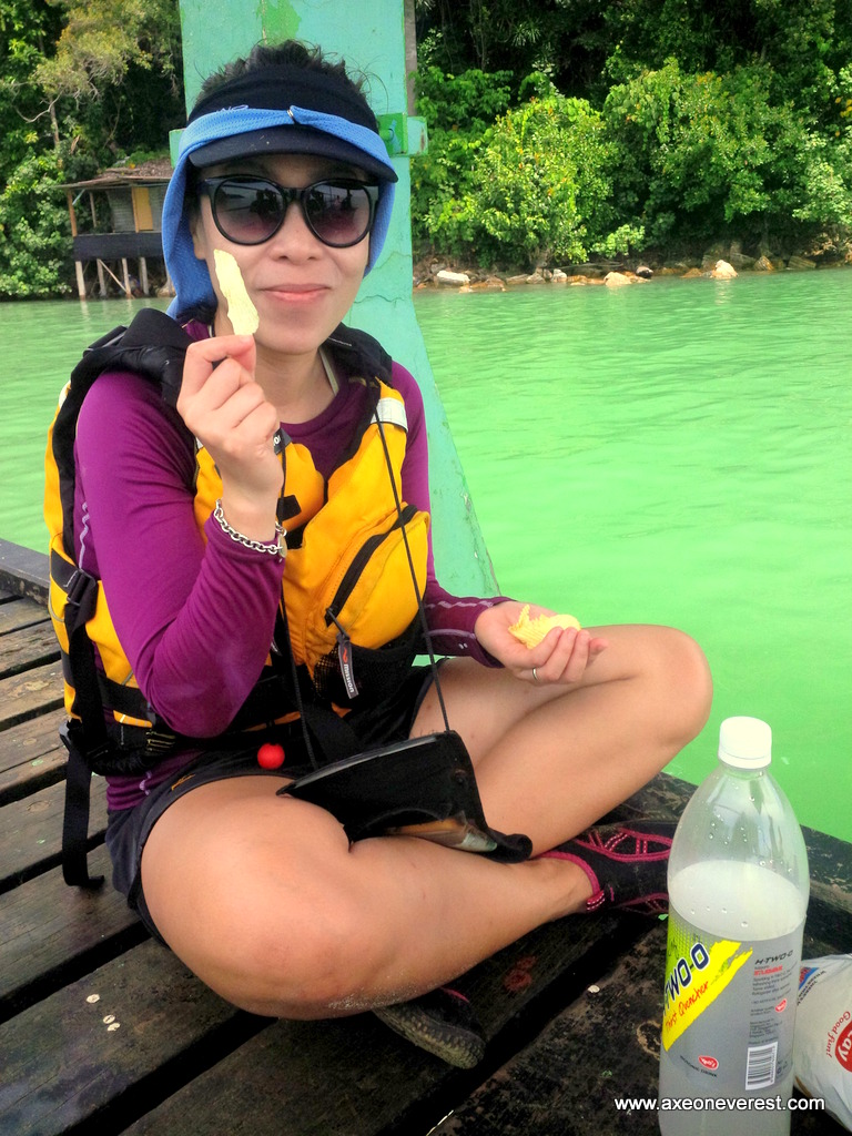
Stephanie having lunch on the jetty on Pulau Pisang.
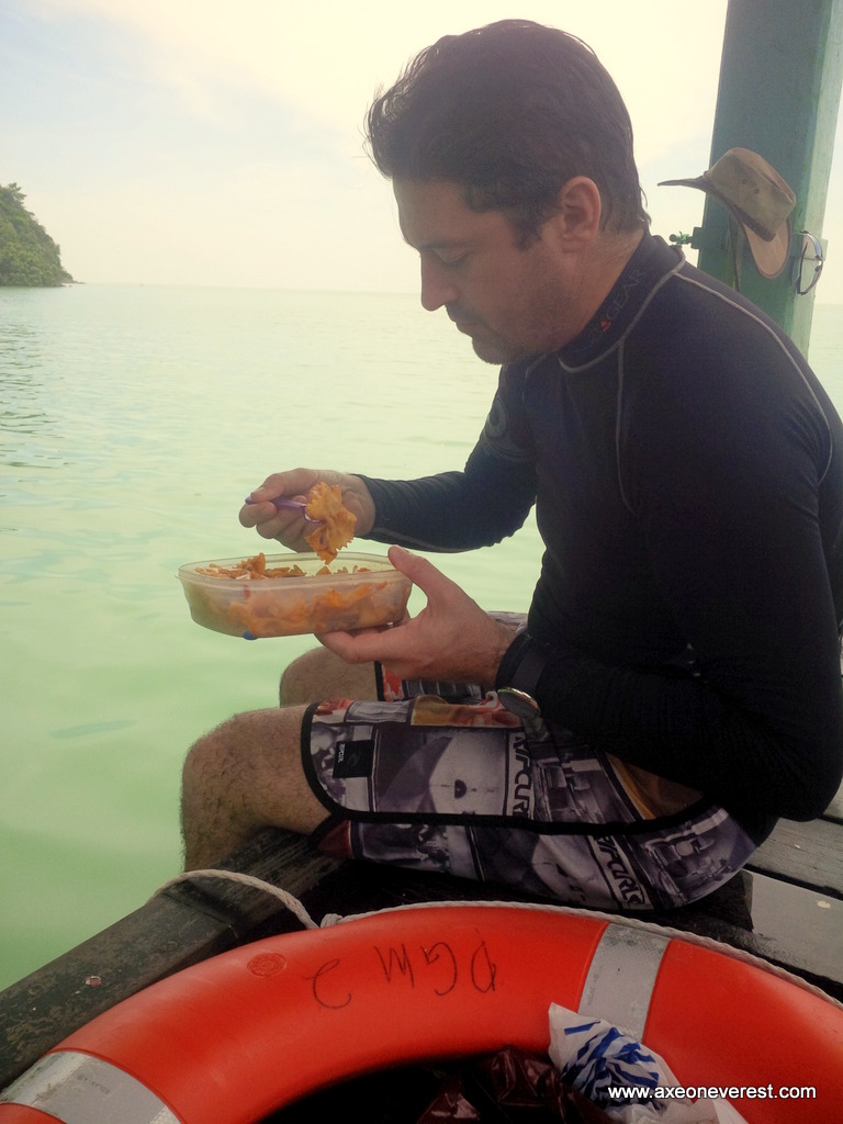
Glassy tucking into his delicious pasta lunch which he shared with us.

On the way home. The mainland looks a long way away and we were concerned about the wind picking up. We made it back in 2h15mins.

V for Victory! I was very proud of Stephanie for paddling 28km in an open sea crossing like this. She was pretty tired but never missed a stroke for 5 hours paddling.
Posted on February 2, 2014, in Microadventure, Sea Kayaking, Singapore Micro Adventure and tagged andrew glass, kayaking malaysia, Pulau Pisang. Bookmark the permalink. 7 Comments.


Well done you guys! Cheers x
LikeLike
Cheers Scho – next time you will have to try it on your SUP!
LikeLike
Great stuff. We are very similar in our love for adventure. I live in Singapore where the pace is so hectic I need my adventures to stay sane. I’m paddling my inflatable to pulau pisang tomorrow!
LikeLike
Hi Jeremy, wow! Paddling an inflatable to pulau Pisano and back will be hardcore! We used rigid kayaks with closed cockpits. What type of inflatable do you use?
LikeLike
I’ve got the advanced elements, advanced frame model, closed as well. It had done well on my kayak/ camp trips to the islands in the southern islands. 14 klick isn’t too far away. I don’t expect it to be too difficult specially considering that the straits is relatively sheltered. Or am I wrong?
LikeLike
If its a closed cockpit it should be ok. I definitely would not do it in an open cockpit as it gets quite choppy. Being an offshore paddle the wind is your main issue. Predominantly North Easterly at this time of year and it can blow quite strong. Just take the normal precautions for any serious offshore paddle. Make sure people know where you are going and you have some form of comm’s to someone who can help if you get in trouble, carry the necessary safety and navigation kit. As with any offshore paddle, in the right conditions it seems easy, in the wrong conditions you can suddenly find yourself in a very serious situation where you are rapidly losing control of the situation. Have fun and safe paddling!
LikeLike
Pingback: Inspiring People: Andrew Glass – human power from Singapore to Pulau Tengah | Grant 'Axe' Rawlinson